
28 Haverhill Road - Site Plan Review

Gallery
Project details
What is proposed
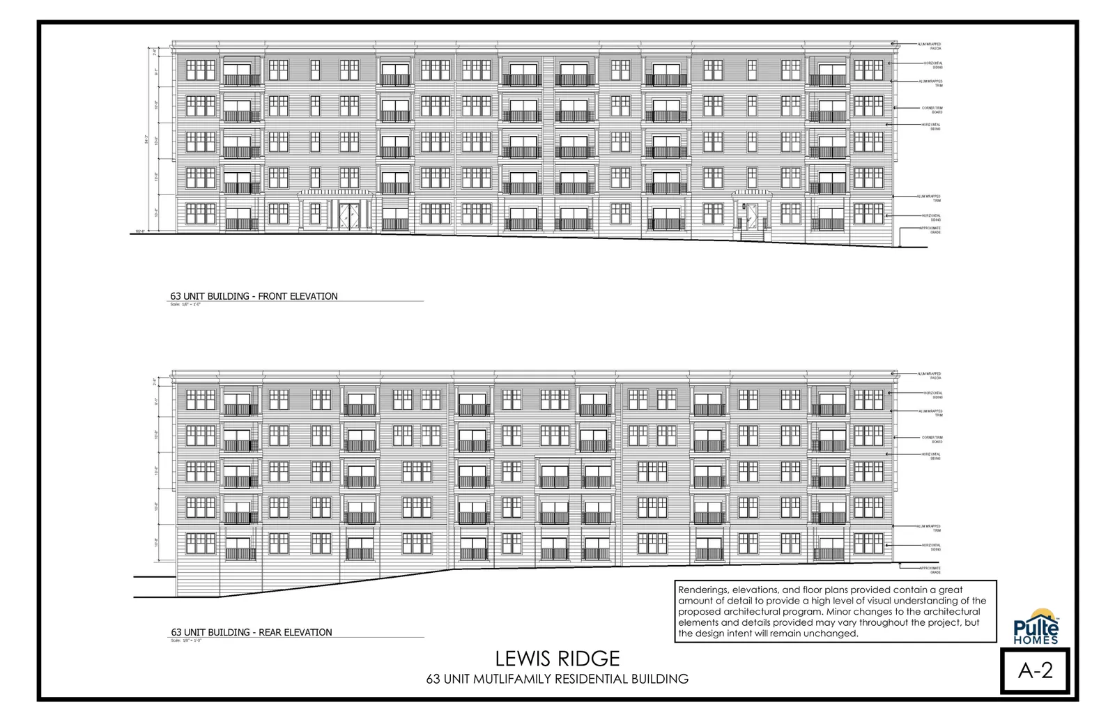
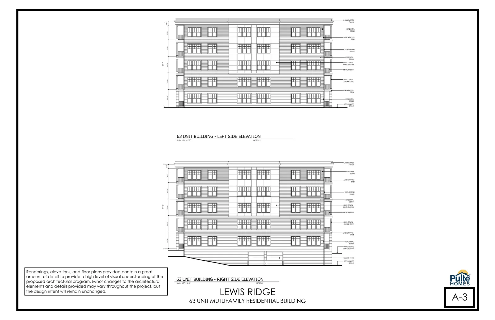
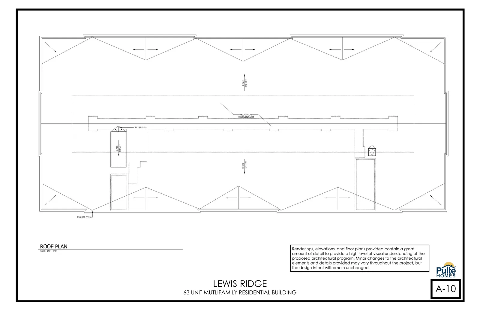
The Lewis Ridge proposal would place a home‑ownership condominium community at 28 Haverhill Road comprised of 126 units contained in two matching five‑story, garden‑style residential buildings (63 units per building). Each building is shown as five stories of living above a subsurface garage level; units are a mix of one‑ and two‑bedroom floor plans. Twenty percent of the dwellings (25 units) are designated as affordable and are proposed for inclusion on the state Subsidized Housing Inventory under applicable requirements.
Where and how big
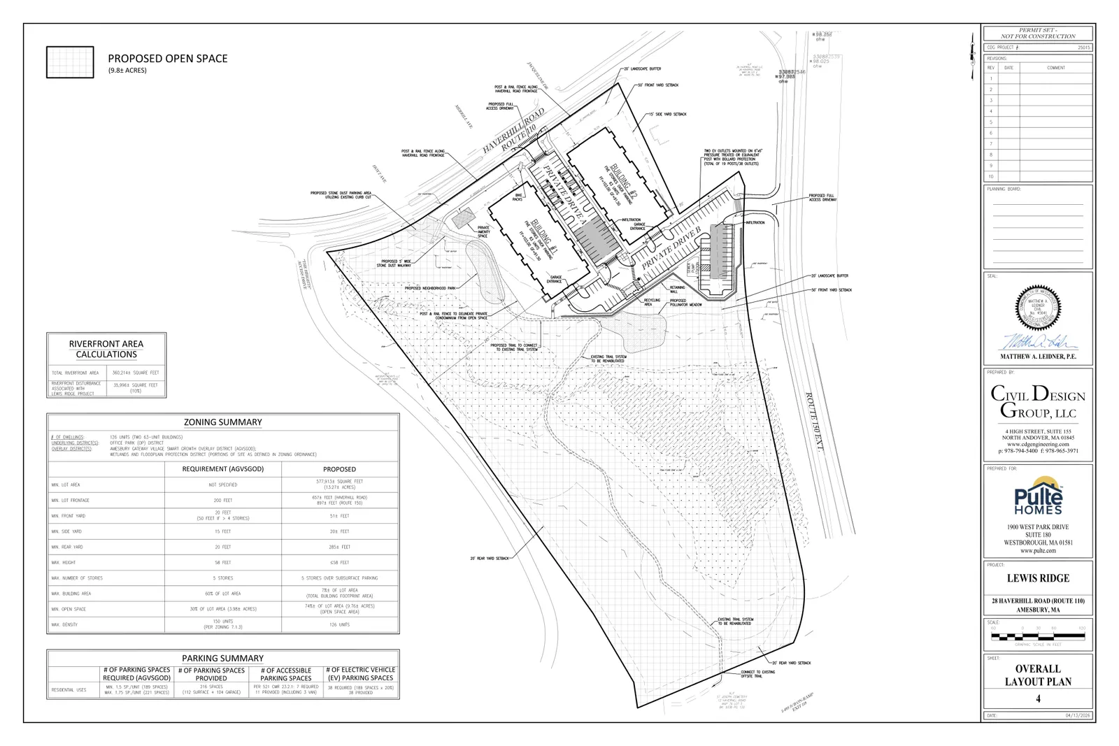
The project site is Assessor’s Map 76 Lot 1 and totals about 13.27 acres with frontage on Haverhill Road and Hillside Avenue (Route 150 Extension). Wetland resource areas including a perennial stream bisect the parcel; the applicant’s materials limit the developed footprint to roughly 3.5 acres in the northern portion of the site. The remainder of the property (about 9.8 acres) is shown as passive open space with a neighborhood park, walking path, trail connections and a pollinator meadow. The development is proposed to operate under a condominium master deed and declaration.
Parking, access and transportation
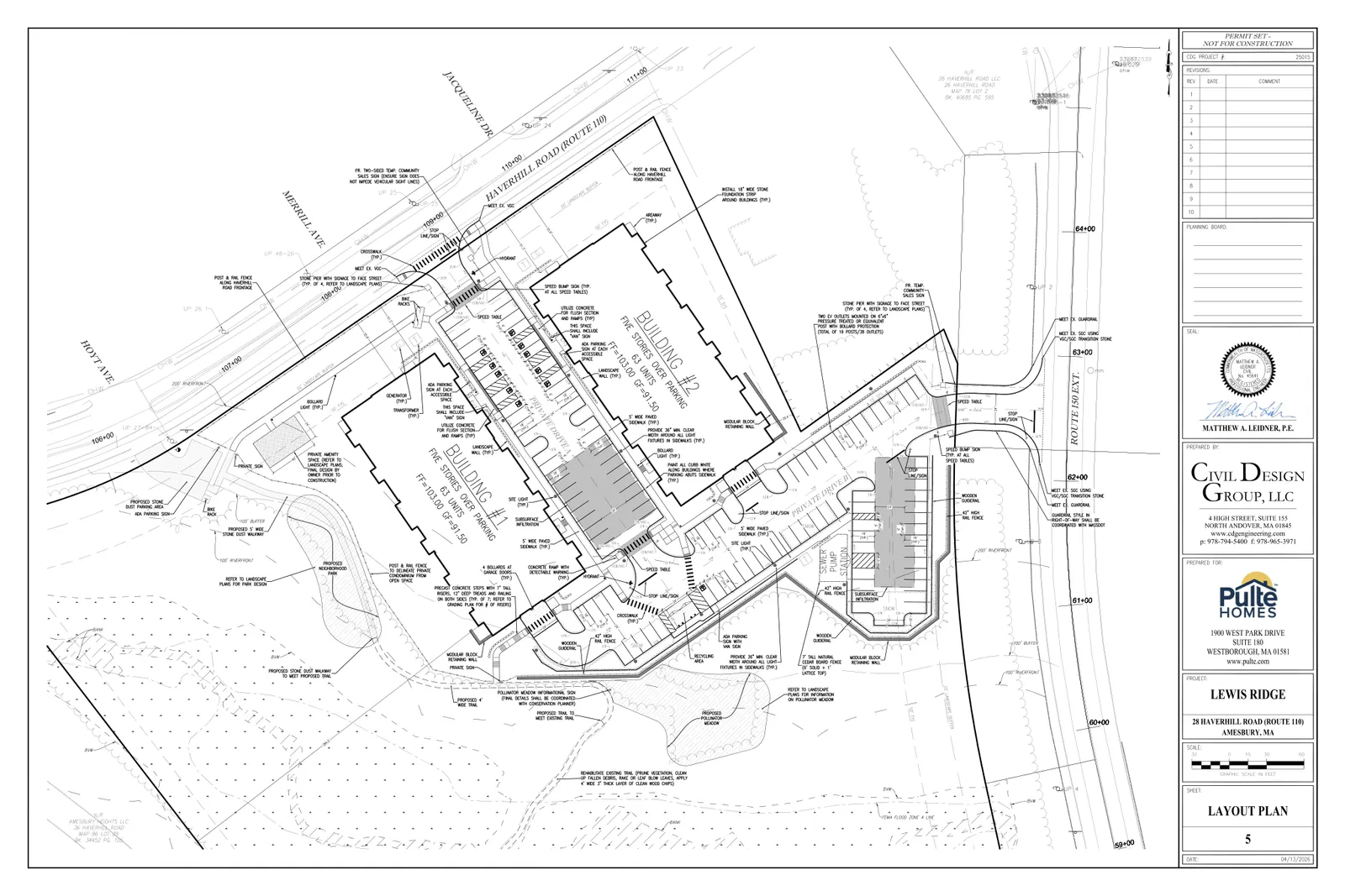
The submission proposes 216 parking spaces (104 covered in the below‑building garages and 112 surface spaces), five accessible spaces adjacent to main building entrances, and secure bicycle parking inside the garages. The plans identify electric‑vehicle charging outlets in the surface lot (materials identify 38 EV outlets). Vehicular access is shown as two full‑access driveways: one on Haverhill Road and one on Hillside Avenue. A small public stone‑dust parking area and trailhead are proposed off Haverhill Road for trail access. The applicant’s Transportation Impact and Access Study estimates the development will generate approximately 45 vehicle trips in the weekday AM peak and 48 vehicle trips in the PM peak (about 562 daily trips using ITE trip rates); the report includes sight‑line, crash history and intersection operations analyses and notes MassDOT access permits will be required.
Stormwater, wetlands and resource area considerations
Civil and stormwater plans show a post‑construction stormwater management system using pretreatment (deep‑sump hooded catch basins and water quality units) and two subsurface infiltration systems (SIS‑1, SIS‑2). The stormwater report uses HydroCAD and site geotechnical test pit data and reports that the proposed BMPs provide recharge, water quality treatment for TSS and phosphorus, and peak‑flow mitigation for the 2‑, 10‑ and 100‑year design storms; culvert sizing is shown where required. The application states no bordering vegetated wetlands will be disturbed, no floodplain disturbance is proposed, and the project will require review and an Order of Conditions from the Amesbury Conservation Commission. The construction phase is subject to the EPA NPDES Construction General Permit and the applicant states a site‑specific SWPPP will be prepared prior to construction.
Status and next steps
The site plan review application was submitted to the Amesbury Planning Board (April 13, 2026) and the submission package includes architectural renderings and floor plans, civil/site engineering plans, a stormwater management report with an O&M plan, and a Transportation Impact and Access Study. Subsequent approvals identified in the submission include Planning Board site plan approval, MassDOT access permits for the two full‑access driveways, and Conservation Commission review under the Wetlands Protection Act (NOI/Order of Conditions). A zoning waiver for retaining walls greater than 6 feet is included in the submission.
Discussion at meetings
- CONTINUEContinue the Site Plan hearing for 28 Haverhill Road to September 28, 2026.
- CONTINUEContinue the public hearing for 28 Haverhill Road (Amesbury Gateway Village Smart Growth District) to the Planning Board meeting of September 14, 2026.
- APPROVEApprove payment of the Stantec invoice (invoice listed in packet) for peer review services related to 28 Haverhill Road in the amount shown ($19,921).
- APPROVEAccept Stantec's peer review proposal for civil engineering, traffic, and environmental review for 28 Haverhill Road and require the applicant to fund the contract.
- OTHERto request staff find peer review for the areas mentioned
- CONTINUEto continue the public hearing on 28 Haverhill Road to June 8th
Documents on file


