
28 Haverhill Road - Resource Area Delineation

Gallery
Project details
What is proposed
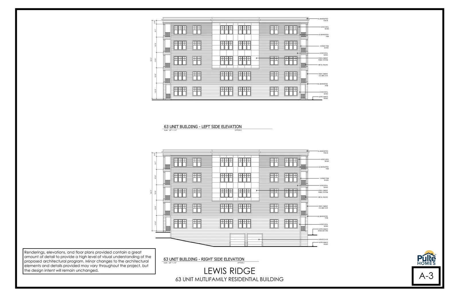
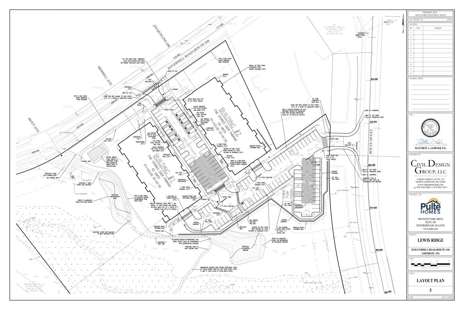
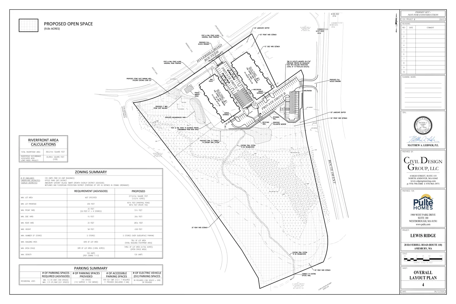
Pulte Homes of New England proposes Lewis Ridge, a multifamily residential development at 28 Haverhill Road consisting of two residential buildings (two 63‑unit buildings, 126 units total), associated parking, internal access drives, community amenities, a neighborhood park, pedestrian connections/trails, and landscaping and stormwater management infrastructure.
Where and how big
The site is a single parcel of about 13.274 acres (577,913 square feet). Proposed buildings are below the 58‑foot zoning height limit. The plans show 216 parking spaces (112 surface, 104 garage) and identify approximately 9.8 acres of open space within the parcel; 38 electric‑vehicle charging‑capable spaces are indicated on the site plan.
Wetlands, floodplain and site‑specific considerations
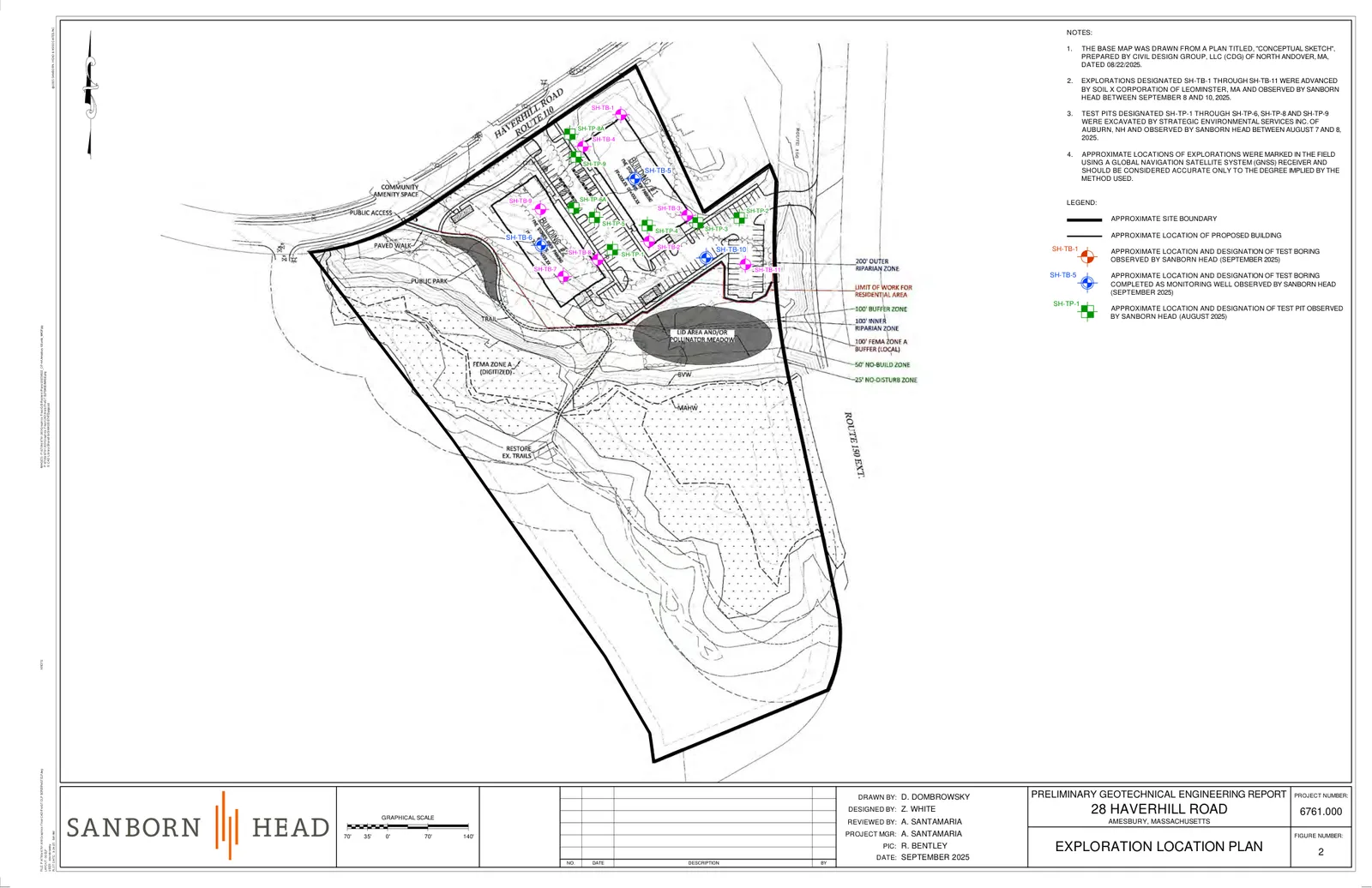
Field delineation of wetland resources was performed by VHB (August 29, 2025). An Abbreviated Notice of Resource Area Delineation (ANRAD) was filed (12/15/2025); the Conservation Commission completed a peer review and approved the wetland boundaries and the applicant is awaiting issuance of an Order of Resource Area Delineation (ORAD). Resource areas shown on the plans and discussed in the Notice of Intent include Bank, Bordering Vegetated Wetland (BVW), Bordering Land Subject to Flooding (BLSF) and the 200‑foot Riverfront Area (RFA) associated with an unnamed perennial stream. (The Riverfront Area is the land measured horizontally from the stream’s mean annual high‑water line out to 200 feet; the submission identifies proposed alteration of 58,216 sq ft of RFA, with 6,796 sq ft in the inner 0–100 ft zone and 51,420 sq ft in the 100–200 ft outer zone.)
A portion of the site is mapped within FEMA Zone A floodplain. The NOI states no general work is proposed within BLSF except for an existing trail; wetland and floodplain limits are shown on the plans.
Parking, access and stormwater
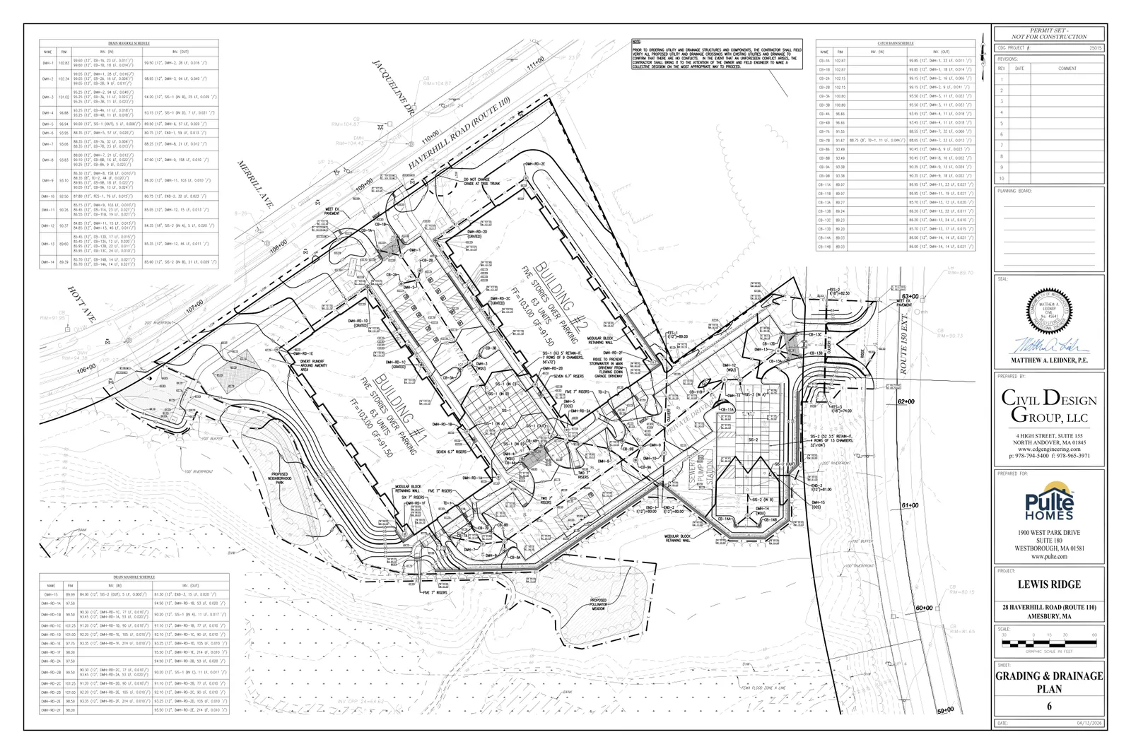
Access is shown from Haverhill Road with internal drives, surface parking and attached garage parking. The submission includes a Stormwater Management Report and detailed site drainage plans. Erosion and sediment controls shown on the plan set include silt fence, wattles, stabilized construction entrances, sedimentation basins, and diversion berms; the applicant indicates preparation of a Stormwater Pollution Prevention Plan (SWPPP) to meet NPDES Construction General Permit requirements and compliance with MassDEP Stormwater Management Standards.
Status and filings
A Notice of Intent (WPA Form 3) and supporting materials (site plans, stormwater report, ANRAD) were filed with the Amesbury Conservation Commission and with MassDEP (eDEP Transaction #1995865). Local and state NOI filing fees were submitted. The Conservation Commission advertised a public hearing (virtual) for May 4, 2026 at 6:30 p.m. The ANRAD was peer‑reviewed and the Commission approved the wetland boundaries; issuance of the ORAD is pending. The project has also been submitted to the Amesbury Planning Board for site plan review.
Discussion at meetings
- CONTINUEContinue the public hearing for 28 Haverhill Road (NOI 002-1365) to October 5, 2026.
- APPROVEApprove payment of the presented invoices (including Stantec invoice for 28 Haverhill Road and CCAM Environmental invoices).
- CONTINUEContinue the NOI for 28 Haverhill Road (NOI 002-1365) to the September meeting.
- APPROVEApprove the Stantec proposal to perform the stormwater peer review (and related wetland review/meeting attendance) for NOI 002-1365 at 28 Haverhill Road.
- OTHERObtain a stormwater peer review for NOI 002-1365 28 Haverhill Road, coordinated with the Planning Board and contracted to a firm that can also perform a wetlands impact peer review.
- CONTINUEI just want to make a motion to continue.
- APPROVEI move that we require a peer review.
- CONTINUESo we can make a motion to continue to that meeting.
Documents on file


