
2 and 13 Merrimac St - Notice of Intent
Redevelopment of the Marina at Amesbury Point at 2 & 13 Merrimac Street: new marina building with restaurant, stormwater upgrades, reduced impervious area, and buffer‑zone plantings, filed as a Notice of Intent to the Conservation Commission.

AI summary
A Notice of Intent has been filed to redevelop the Marina at Amesbury Point (2/14 and 13 Merrimac Street) including a new marina building with a restaurant, renovation of one existing maintenance building, and regrading of an auxiliary gravel parking area. The project reduces on‑site impervious area by about 7,295 sq ft, adds stormwater treatment (deep‑sump catch basins, Contech CDS unit, rain garden), provides buffer‑zone plantings, and reports a net increase in flood storage; construction is estimated to take 14–16 months. The proposal involves work within Riverfront Area, Bordering Land Subject to Flooding, and altered buffer zones and includes waiver requests to the local wetlands ordinance and coordination with NHESP.
Gallery
Project details
What is proposed
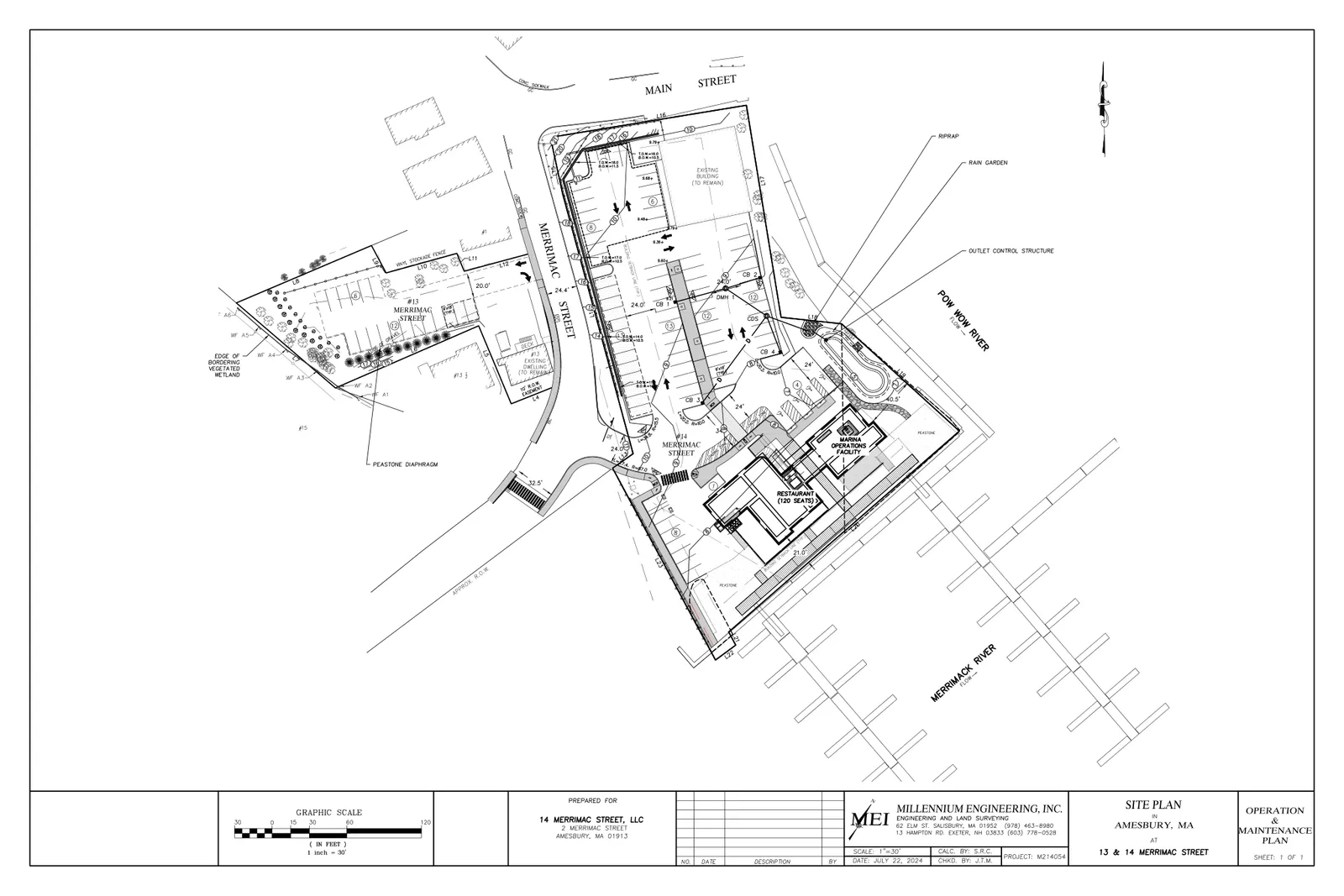
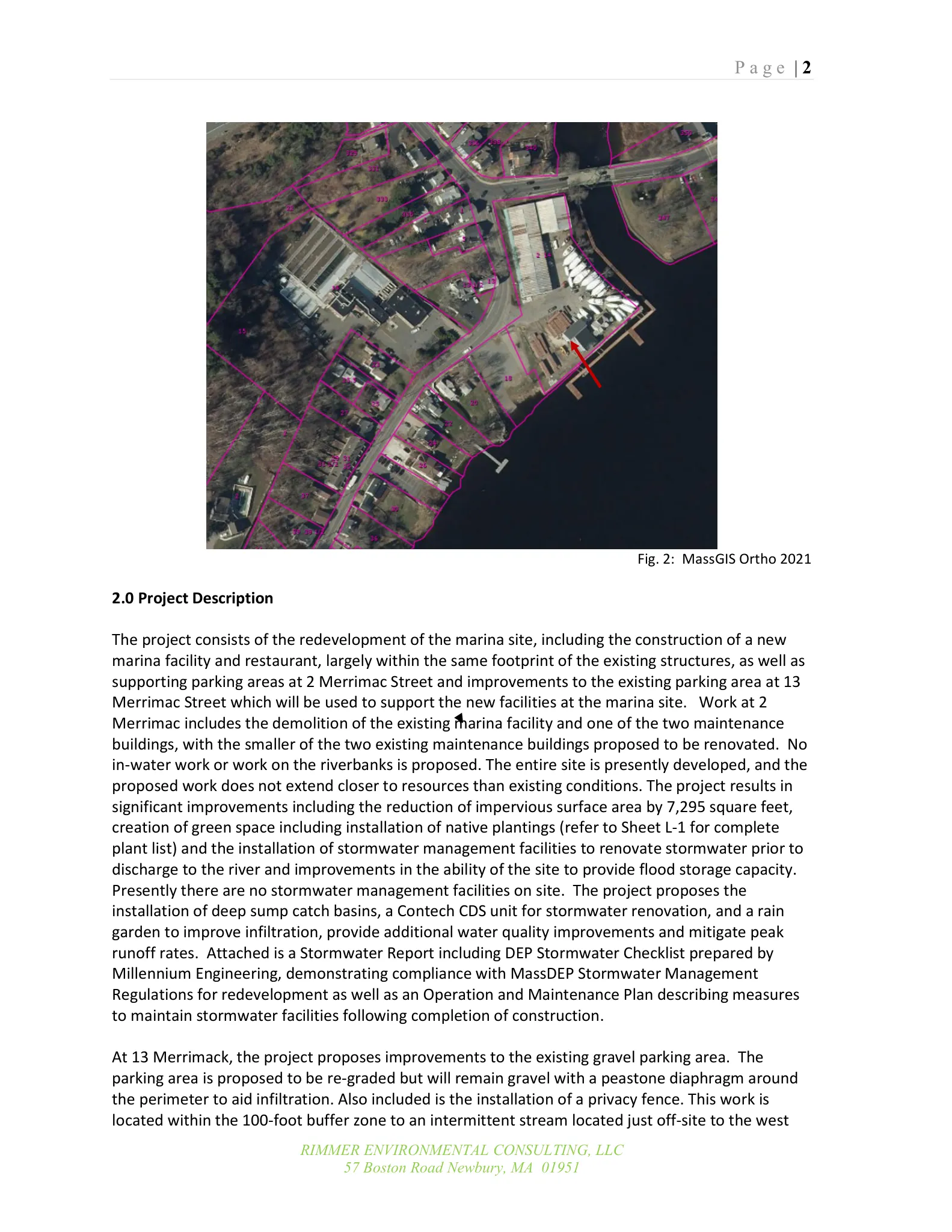
The project proposes redevelopment of the existing marina at 2 (also referenced as 14) Merrimac Street and related improvements at 13 Merrimac Street. At 2 Merrimac the proposal calls for demolition of the existing marina facility and one maintenance building, renovation of the smaller maintenance building, and construction of a new marina facility with an associated restaurant; no in‑water work or alterations to riverbanks are proposed. At 13 Merrimac the work consists of regrading the existing gravel parking area, retaining it as gravel with a peastone diaphragm at the perimeter to aid infiltration, and installing a privacy fence.
Where and how big
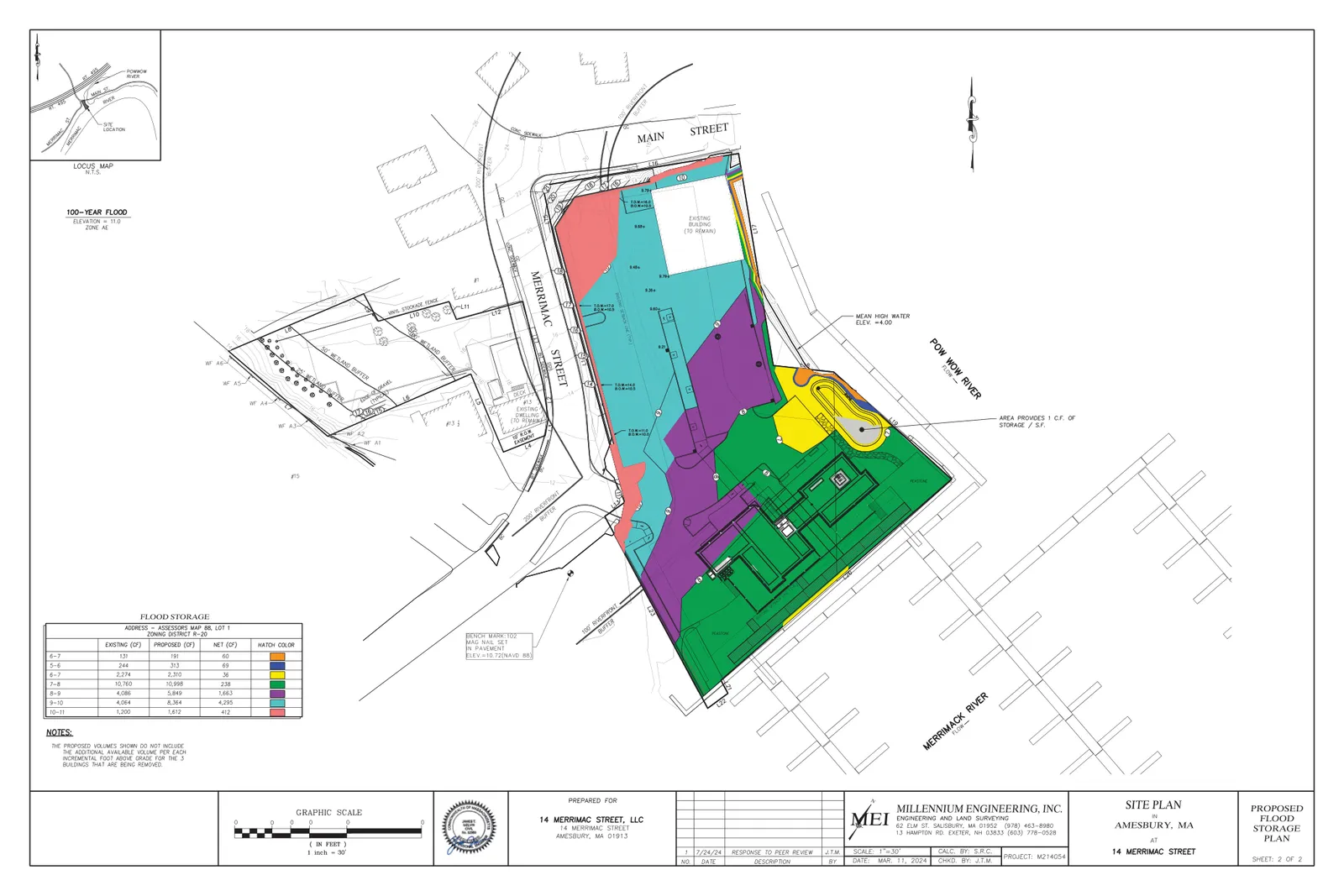
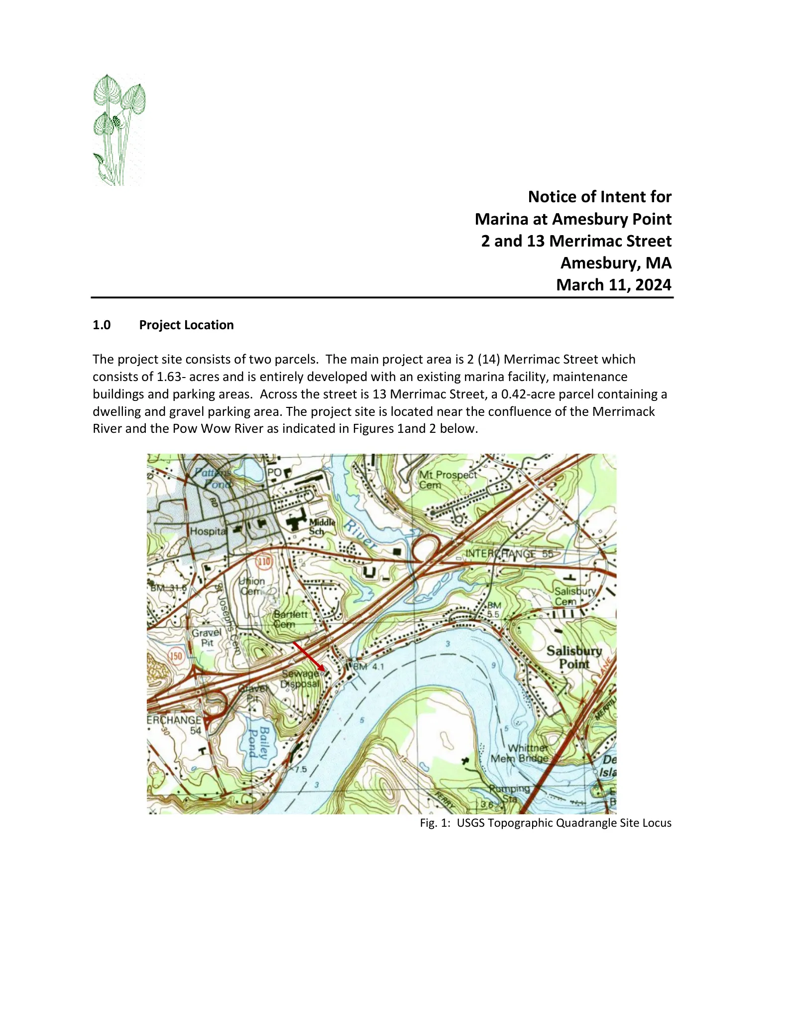
The site comprises two parcels: about 1.63 acres at 2 Merrimac Street and about 0.42 acres at 13 Merrimac Street, located at the confluence of the Merrimack River and the Pow Wow River. The redevelopment reduces impervious area on the site from 60,829 square feet to 53,535 square feet (a net reduction of 7,295 square feet, or roughly 12%). Approximately 67,378 square feet of the 2 Merrimac Street parcel lie within Bordering Land Subject to Flooding (FEMA 100‑year elevation = 11.0 NAVD88). The proposed building first floor is designed to be 6 feet 8 inches above the floodplain; at‑grade elements (stairs, elevator lobbies, chases) are to be designed as breakaway in severe floods.
Parking, access and stormwater controls
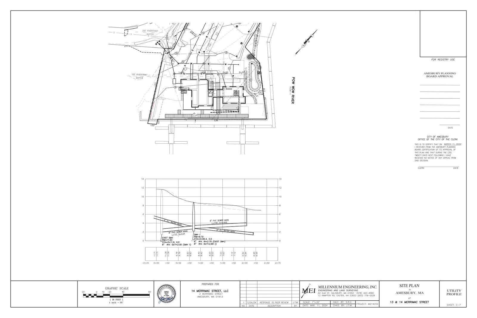
Parking and access are redeveloped largely within existing paved footprints on 2 Merrimac Street. The gravel parking at 13 Merrimac Street will be regraded and maintained as gravel with a peastone diaphragm to encourage infiltration. Stormwater management measures include deep‑sump/hooded catch basins, an underground Contech CDS2015‑4 treatment unit, and a planted rain garden for treatment and infiltration. The submission includes a Stormwater Management Report, a Stormwater Pollution Prevention Plan for construction (NPDES), and an Operation & Maintenance (O&M) manual that specifies inspection and cleaning schedules (e.g., CDS inspection twice yearly; catch basin cleanings), recommended maintenance tasks for the rain garden, and an illustrative annual O&M cost estimate of about $2,900.
Special considerations and regulatory items
The entire 2 Merrimac parcel lies within the 200‑foot Riverfront Area; the applicant characterizes the proposal as a redevelopment under 310 CMR 10.58(5), noting the project will not extend closer to the river than existing conditions, will reduce impervious area, add native plantings, add stormwater treatment, and increase on‑site flood storage (reported net gain of 1,762 cubic feet). Work is proposed within previously altered buffer zones; the filing includes a request for waivers to the Amesbury Wetlands Ordinance no‑build zones on the basis that the buffer is already developed and that restorative measures are proposed (native plantings, debris removal, stormwater and flood storage improvements). An intermittent stream in a paved sluiceway adjacent to 13 Merrimac is identified; about 1,200 square feet of the buffer near that channel is proposed for enhancement with native shrub plantings. The NOI notes potential overlap with NHESP Priority/Estimated Habitat and indicates that NHESP will be provided a copy for review.
Status and next steps
The Notice of Intent and supporting materials (site plans, stormwater report, O&M plan, flood storage exhibit, waiver request) were submitted to the Amesbury Conservation Commission (NOI dated March 11, 2024). The filing identifies preparation of the required construction‑phase erosion controls and an NPDES Stormwater Pollution Prevention Plan for the greater‑than‑one‑acre construction activity. The NOI includes a proposed construction schedule and sequence estimating 14–16 months for construction from mobilization to completion. The application is under review by the Conservation Commission and related agencies as required by the Wetlands Protection Act and local ordinance.
Discussion at meetings
- APPROVEIssue a Partial Certificate of Compliance for RCOC 002-1271 at 2 Merrimac Street, requiring establishment of plantings for one more growing season and continuation of the performance bond.
- CONTINUEI move that we continue the hearing to next month pending word from National Heritage.
- AMENDA motion to approve the waiver request for landscaping within the 25’ no disturb zone.
- AMENDA motion to approve the waiver request for an elevated building within 35’ of the water.
- APPROVEA motion to conditionally approve NOI 002-1330 2 and 13 Merrimac Street as presented and discussed.
- APPROVEApprove stormwater peer review for 2 and 13 Merrimac Street (NOI 002-1330)
Documents on file


