
14 Lake Attitash Road - Notice of Intent
Small addition and stair reconstruction at a lakefront single‑family property with erosion controls and an Order of Conditions from the Conservation Commission.

AI summary
The project proposes a small addition and reconfigured exterior stairs at a single‑family lakefront property at 14 Lake Attitash Road in Amesbury. The site is about 6,490 square feet and abuts Lake Attitash; resource areas identified include bank, land under the lake, bordering land subject to flooding, and the buffer zone. The filing includes specified erosion controls (mulch‑filled silt sock), the requirement for a pre‑construction inspection, and an Order of Conditions issued by the Conservation Commission with standard compliance and as‑built submission requirements.
Gallery
Project details
What is proposed
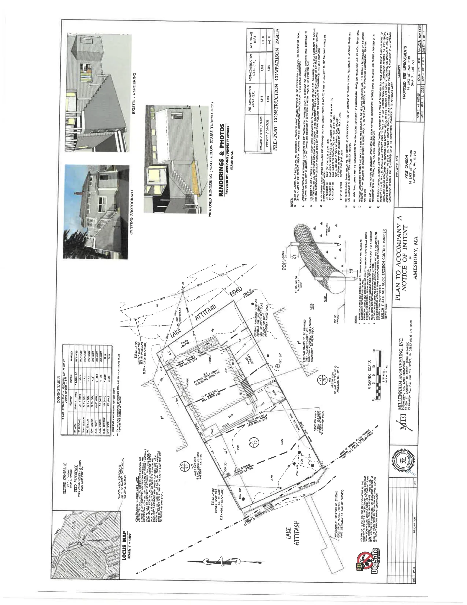
The applicants propose a limited residential alteration at 14 Lake Attitash Road. Work includes construction of a small addition on a slab‑supported foundation, demolition and reconstruction with reorientation of the existing exterior stairs to the second story, removal of a small area of pavement, and excavation for the new foundation.
All proposed work is on an existing single‑family lot and the applicant’s narrative states the changes will not result in a significant net increase in impervious surface.
Where and how big
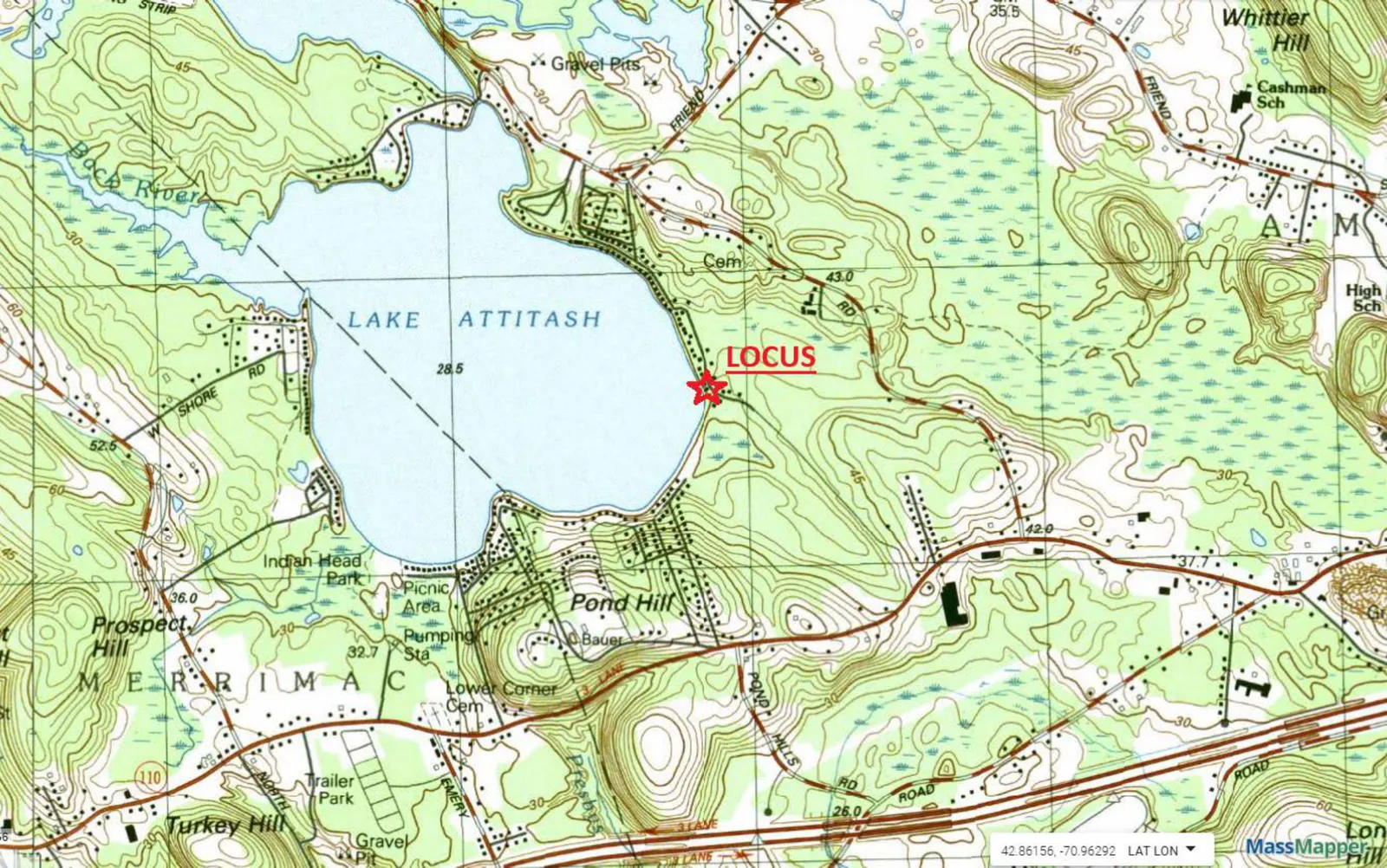
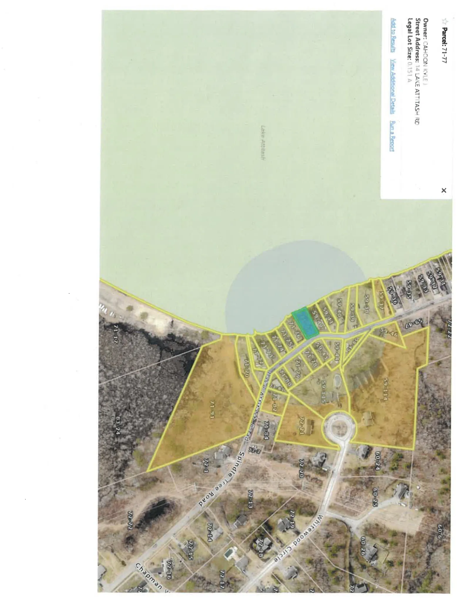
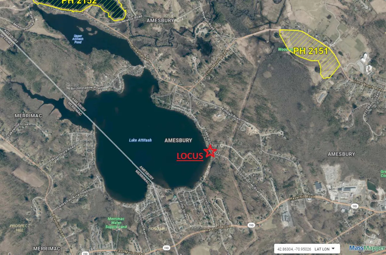
The site is a waterfront parcel on the west side of Lake Attitash in Amesbury, approximately 1,700 feet south of Beech Lane. The lot is about 6,490 square feet and currently contains a single‑family house, a shed, a paved driveway, turf lawn, and landscaped areas. Assessor reference and coordinates provided in the filing are Map 71 / Lot 77 and Latitude 42.848399, Longitude -70.971629.
The application identifies the existing house as the only dwelling on the property; the proposal does not create additional residential units.
Environmental/resource areas and mitigation measures
The applicant’s site survey and narrative identify regulated wetland resource areas adjacent to or near the work area: the Bank (the sloped shoreline at Lake Attitash), Land Under Water Bodies & Waterways (the lake bed adjacent to the property), Bordering Land Subject to Flooding (areas that provide temporary flood storage during high water), and the Buffer Zone (the upland area within 100 feet of the wetland resources). These terms derive from the Massachusetts Wetlands Protection Act and its regulations; they describe features that the Conservation Commission reviews to protect water quality, flood control, and wildlife habitat.
The project materials state that none of the proposed activities are located within or will directly impact the delineated wetland resource areas, and that the work is consistent with the performance standards for those resource areas.
Erosion and sedimentation controls shown on the submitted plans and described in the narrative include the installation of a mulch‑filled silt sock (or approved equivalent) at the work limits, weekly inspections and post‑storm inspections of erosion controls, removal of sediment deposits if they reach 4 inches in depth, and removal of all erosion controls after final stabilization. The narrative also requires that any on‑site material stockpiles be kept at least 50 feet from the lake edge and covered during storm events, and that any fill used be clean (no construction debris).
Parking, access and transportation
The proposal does not include new driveways, new parking areas, or changes to public roads. Access to the property remains from Lake Attitash Road and the submission does not propose changes to curb cuts, public sidewalks, or off‑site transportation infrastructure. Construction access details are managed through the contractor responsibilities and erosion control requirements in the project documents.
Status and next steps
The applicant filed a Notice of Intent (WPA Form 3) with the Amesbury Conservation Commission. Millennium Engineering, Inc. prepared the plans and the project narrative; James T. (TJ) Melvin, P.E. is the listed representative. The NOI included a wetland filing fee allocation showing the state share ($42.50) and the city/town share ($67.50 plus any local fee).
The project materials include an Order of Conditions prepared by the Conservation Commission. An Order of Conditions is the Commission’s written permit under the Massachusetts Wetlands Protection Act that lists conditions the applicant must meet; the documents require compliance with those conditions and with the approved plans. Before work begins, the contractor/homeowner must schedule a pre‑construction inspection with the Conservation Commission agent, post the DEP file number on site, install and maintain approved erosion controls, and contact utility locating services (DigSafe) as needed. After construction and site stabilization, the applicant must submit an as‑built plan and a request for a Certificate of Compliance stamped by a licensed engineer or land surveyor.
If there are questions about timing, inspection, or interpretation of the Order of Conditions, residents and contractors should contact the Amesbury Conservation Commission office or the Commission agent listed in the project materials.
Discussion at meetings
- APPROVEDo I have a motion to approve?
- APPROVEA motion was made by M. Fallon to approve NOI 002-1346 14 Lake Attitash Road.
- CONTINUEMotion to continue NOI for 14 Lake Attitash Road to May 5th.


