
72 Elm St - Request for Determination
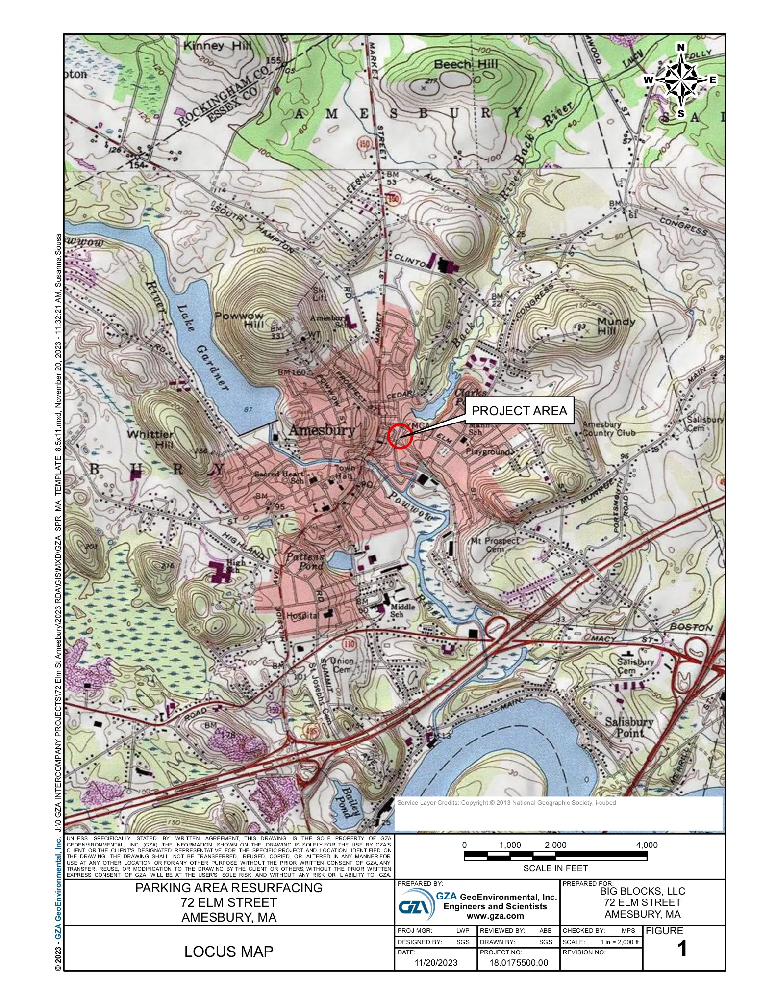
Big Blocks, LLC filed an RDA to repave the existing parking areas around the building at 72 Elm Street (0.35 acre), most of which lies within the 200‑ft Riverfront Area to Plumbush Creek.

AI summary
Big Blocks, LLC has filed an RDA to repave the existing parking around the building at 72 Elm Street (approx. 0.35 acre), with work limited to the current paved footprint and grading to direct runoff to an existing catch basin. The property lies largely within the 200‑foot Riverfront Area to Plumbush Creek; the applicant requests a negative Determination citing 310 CMR 10.58(6)(a) and local regulations because the paved area existed prior to August 7, 1996. The Conservation Commission will decide whether a Notice of Intent (and potential Order of Conditions) is required.
Gallery
Project details
What is proposed
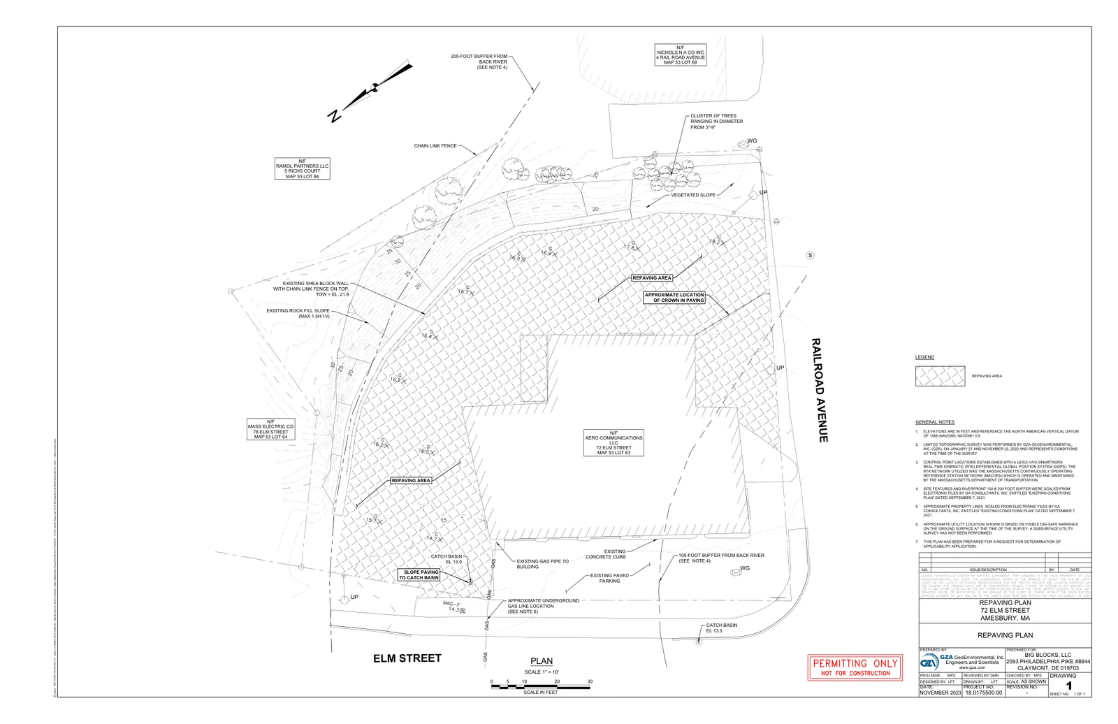
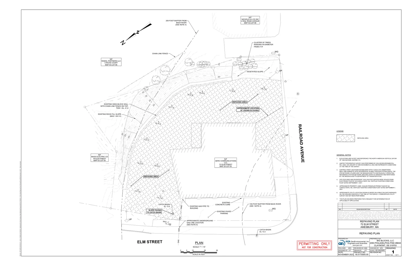
The applicant, Big Blocks, LLC, has submitted a Request for Determination of Applicability (RDA) to repave the existing parking area at 72 Elm Street in Amesbury. The work covers the parking areas on the northern, eastern, and southern sides of the existing building and consists of removing deteriorated pavement and filling localized depressions as needed, placing new asphalt pavement, and grading the repaved surface to provide a positive slope directing runoff to the existing catch basin in the lot.
The filing states there will be no alteration to the existing catch basin structures and no on‑site stockpiling of materials. Utility locations shown on the plan are approximate and based on visible Dig‑Safe markings; no subsurface utility survey was performed as part of this submission.
Where and how big
The site is an approximately 0.35‑acre parcel located at the intersection of Elm Street and Railroad Avenue (Assessors: Map 53, Lot 63). The repaving plan submitted by GZA GeoEnvironmental, Inc. is dated November 2023 (GZA file no. 18.0175500.00) and the plan sheet scale is 1" = 10'. Limited topographic surveying was performed on January 27 and November 22, 2022; elevations are referenced to the North American Vertical Datum of 1988 (NAVD88).
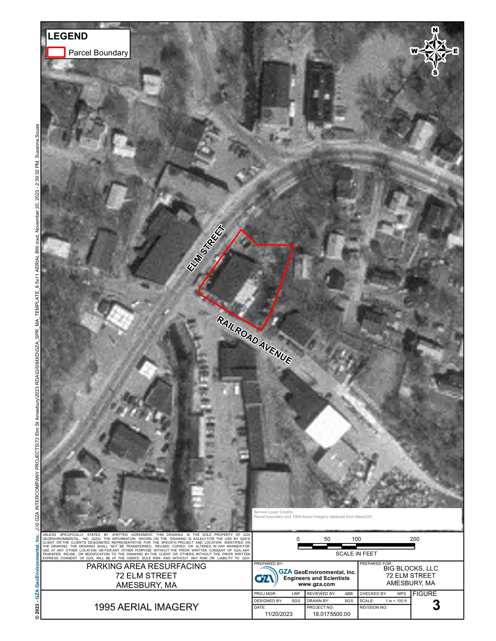
Historical aerial imagery from 1995 is included in the filing and is cited by the applicant to show the parking area was present prior to August 7, 1996.
Site features and environmental considerations
The majority of the parcel lies within the 200‑foot Riverfront Area to Plumbush Creek. Plumbush Creek is treated as a perennial stream in the filing (per 310 CMR 10.58(2)(a)(1)(a) because it appears as perennial on USGS mapping). The plan identifies existing site features including an on‑lot catch basin (plan shows catch basin elevation approximately EL 13.3), a rock‑fill slope and concrete block wall, vegetated slopes, a chain‑link fence at the top of a slope, and small trees (noted as 3–9 inch diameter).
The applicant states the repaving is within the footprint of the existing impervious surface and that paving will stabilize degraded areas and reduce sediment production from loose soil areas. The filing cites 310 CMR 10.58(6)(a) and the Amesbury Wetland Regulations (19.1(d)(1)) and requests a negative Determination of Applicability on the basis that the work is repaving of an impervious area that existed on or before August 7, 1996.
(Technical terms: a Request for Determination of Applicability (RDA) asks the Conservation Commission whether the proposed work is subject to the Massachusetts Wetlands Protection Act or local wetlands bylaws. A Notice of Intent (NOI) is the formal filing used when work is subject to the Act and can lead to an Order of Conditions, which is the wetlands permit issued by the Commission.)
Parking, access and utilities
The submittal is limited to resurfacing and regrading the existing parking footprint; it does not propose changes to parking layout, number of spaces, or vehicle access. Runoff from the repaved areas is planned to be directed toward the existing catch basin shown on the plan. Utility markings shown on the plan (including a gas line to the building) are noted as approximate and based on visible field markings; no new utility work or subsurface utility survey is included in the application.
Status and next steps
The RDA package (WPA Form 1, site figures/plan, copy of the 2022 Determination of Applicability, and certified abutters statement) was submitted to the Amesbury Conservation Commission and a copy was provided to MassDEP’s Northeast Regional Office. The applicant requests a negative Determination of Applicability under the cited regulatory provisions. If the Conservation Commission agrees and issues a negative Determination, the Commission is indicating the work does not require a Notice of Intent under the Wetlands Protection Act.
If the Commission instead determines the work is subject to the Act, the applicant would need to file a Notice of Intent; a Notice of Intent is the formal application that can result in an Order of Conditions (the wetlands permit) from the Commission. The filing references a related Determination of Applicability issued December 12, 2022 for prior pavement work on the site.
If you would like, I can extract and list the plan’s numeric survey elevations, distances to the riverfront or 100/200‑foot buffers as shown on the sheet, or prepare a one‑page checklist of items the Commission commonly reviews for repaving work within a Riverfront Area (e.g., erosion controls, staging, catch basin protection).
Discussion at meetings
- APPROVEApprove NOI 002-1328 72 Elm Street


