
4 Pleasant Valley Road - Notice of Intent
Notice of Intent to install a seasonal, bottom-anchored float and aluminum gangway at 4 Pleasant Valley Road on the Merrimack River, including a 4'x4' platform and five floating sections.

AI summary
A Notice of Intent filed for 4 Pleasant Valley Road seeks permission to install a seasonal floating dock system consisting of a 4' x 4' platform, a ~3' x 35' aluminum gangway, and five float sections (three 4' x 20' and two 8' x 20'), anchored with helical anchors or habitat mooring blocks. The site is an approximately 14,451 sq ft parcel on the Merrimack River; the filing reports 3,572 sq ft of Riverfront Area on site and a proposed 16 sq ft alteration. The application was submitted in March 2025, NHESP was notified because the site is in mapped Estimated Habitat, and the Conservation Commission scheduled a public hearing for April 7, 2025; the Commission will issue an Order of Conditions after review.
Gallery
Project details
What is proposed
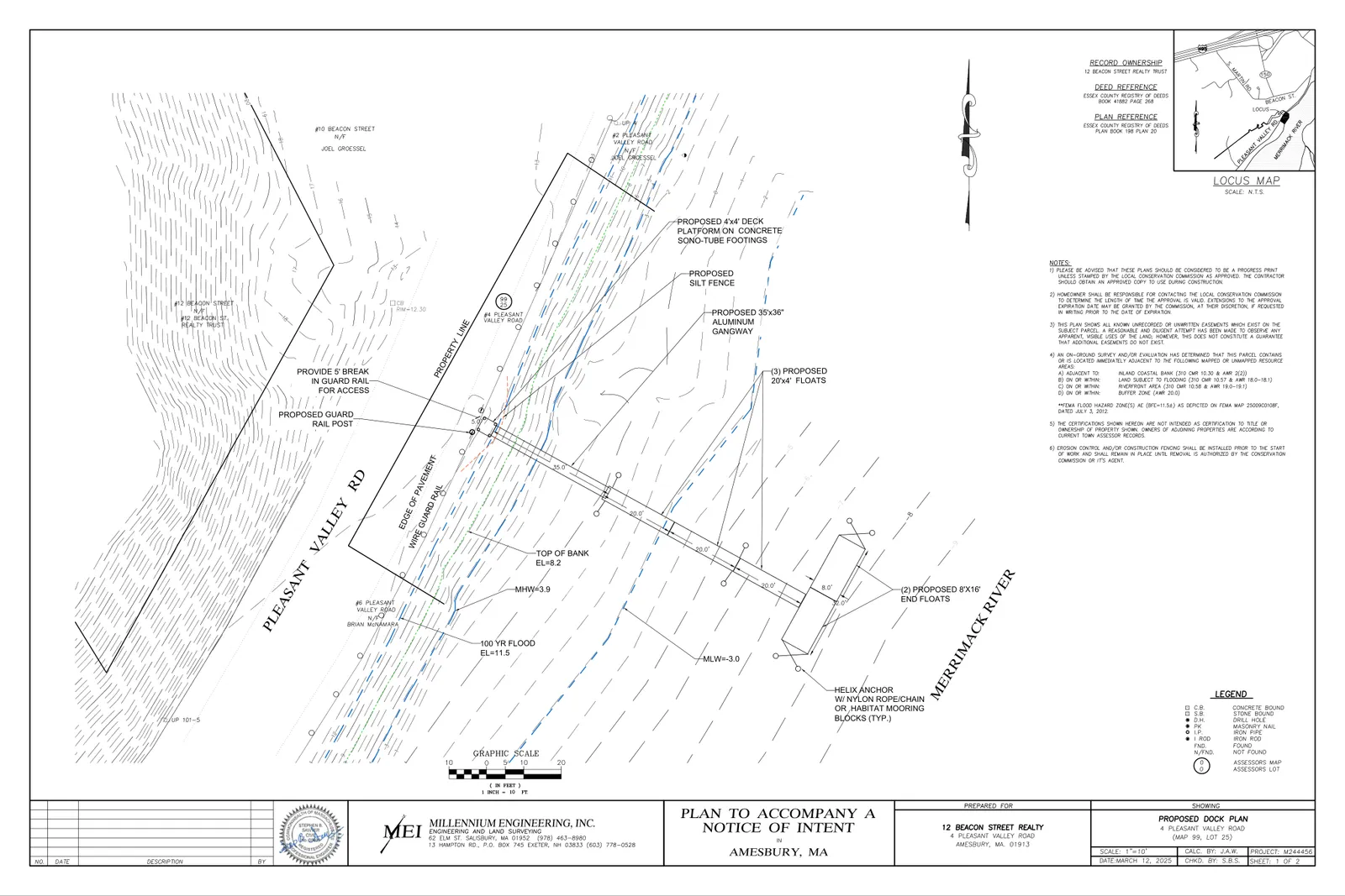
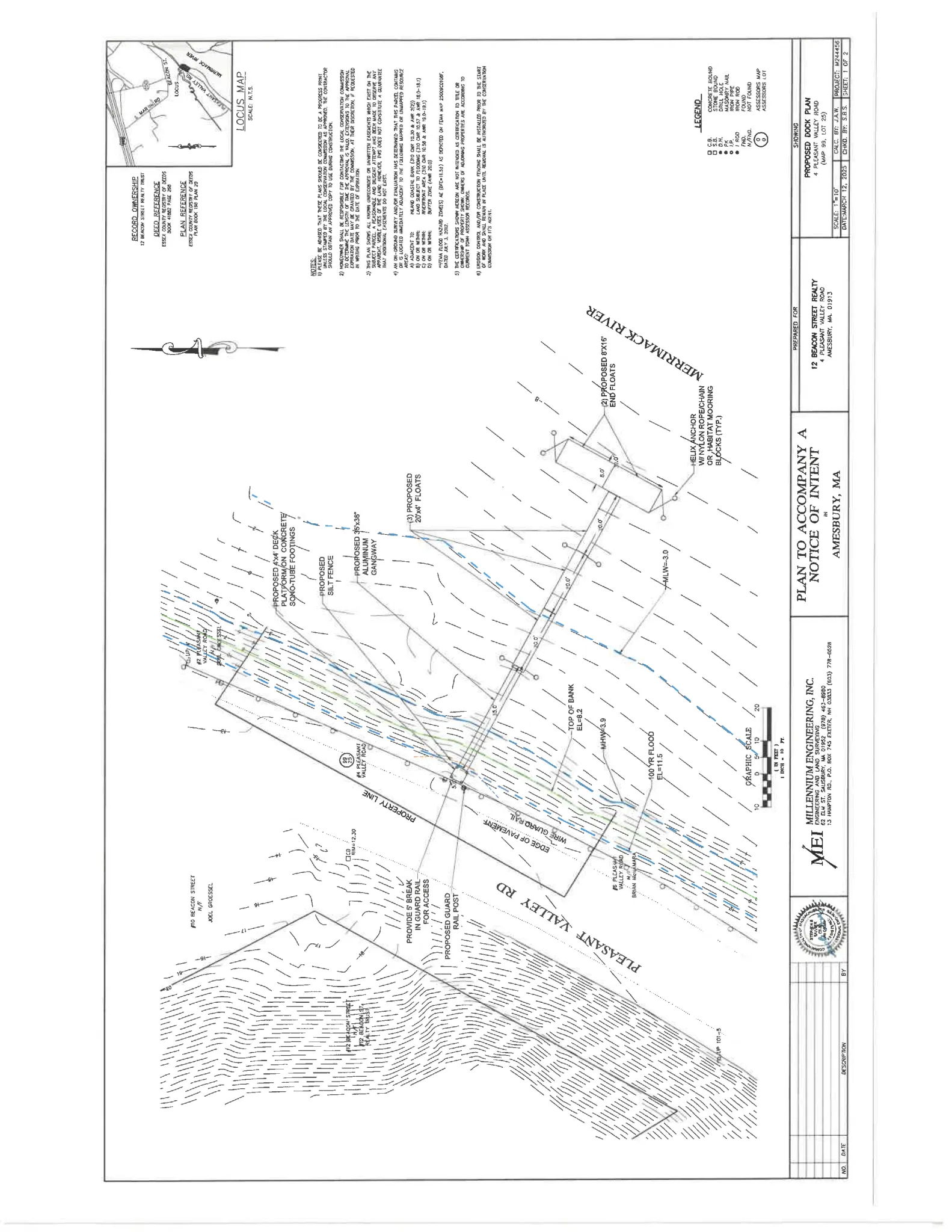
The applicant proposes to install a small seasonal floating dock system on the Merrimack River at 4 Pleasant Valley Road. The proposed components are a 4' x 4' elevated deck platform at the top of the bank, an aluminum gangway/ramp approximately 3' x 35' spanning the rip-rap slope, and modular floating sections listed in the filing as three 4' x 20' floats and two 8' x 20' floats.
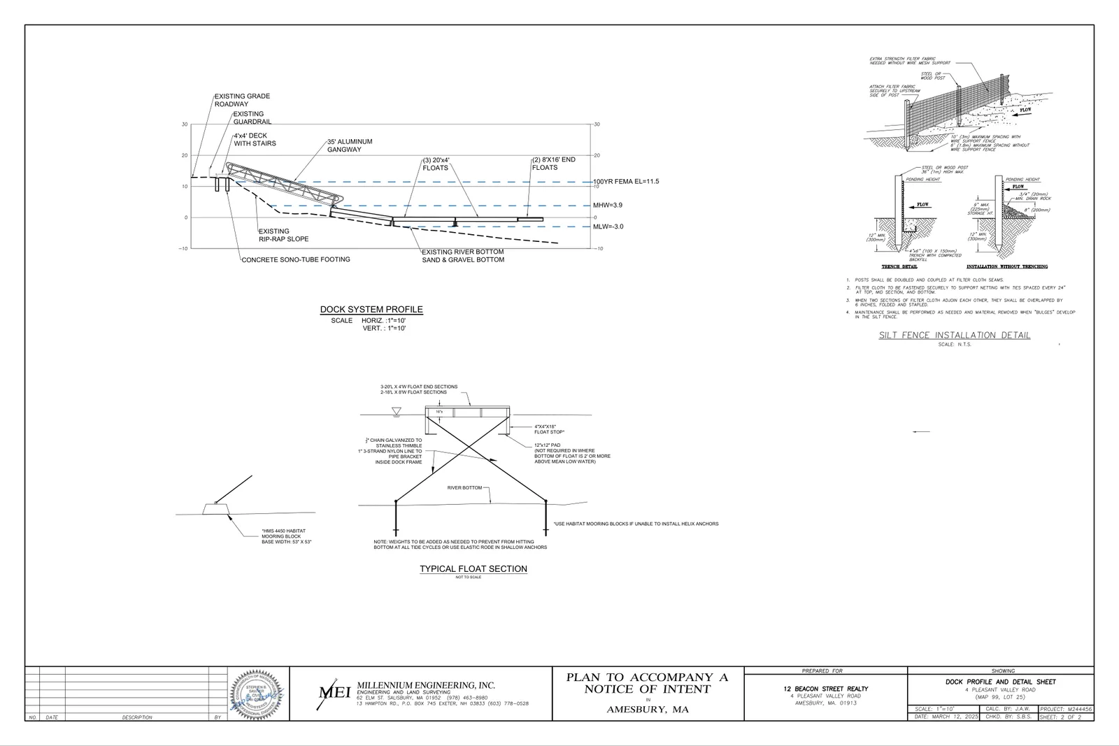
The float system is described as seasonal and bottom‑anchored. Anchoring will be by helical anchors where substrate conditions allow, with concrete "habitat mooring blocks" as an alternative if the bottom is too coarse for screw anchors. Elastic rodes or elastic nylon line with chain are proposed to connect anchors to the floats in a way intended to prevent chain contact with the river bottom. Float stops are shown on the plans to keep the bottom of floats at least 18 inches above the river bottom at low tide.
(Definitions: a Notice of Intent is the formal wetlands application submitted to a local Conservation Commission describing proposed work in or near regulated resource areas; an Order of Conditions is the Commission’s written decision that grants, denies, or imposes conditions on such work. A helical anchor is a steel shaft with helical plates rotated into sediment to secure anchors in place; a habitat mooring block is a weighted concrete block placed on the river bottom used when in‑ground anchors cannot be installed.)
Where and how big
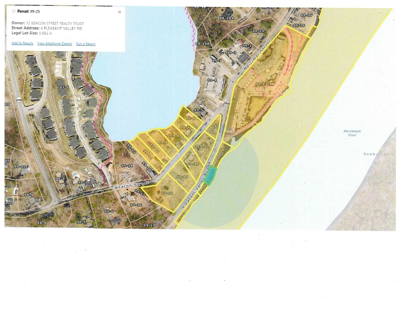
The site parcel is described in the filing as about 14,451 square feet, located between Pleasant Valley Road and the Merrimack River. The submission maps the Riverfront Area on the site as 3,572 square feet and reports a proposed alteration of 16 square feet of Riverfront Area (16 sq ft within the first 100 feet).
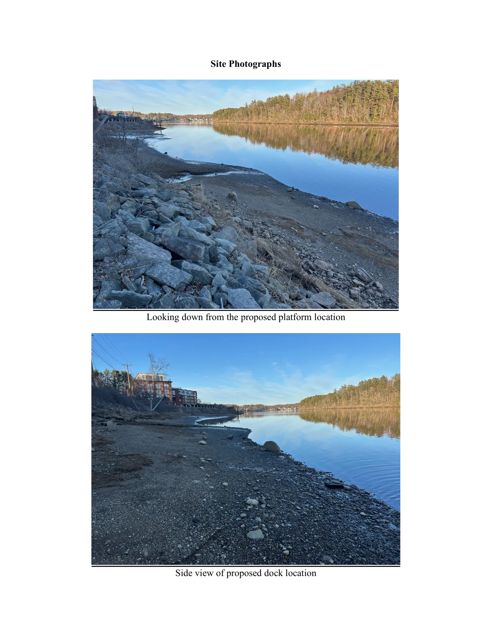
Elevation and tidal data shown on the plans include Mean High Water (MHW) = +3.9 ft, Mean Low Water (MLW) = -3.0 ft, and FEMA 100‑year elevation = +11.5 ft. The bank at the proposed access location is armored rip‑rap supporting the roadway; the gangway is shown spanning the rip‑rap rather than grading or reconfiguring the bank.
Design, materials and construction details
Plans and the project narrative specify an above‑bank platform on concrete sonotube footings, a 35‑foot aluminum gangway/gangway stairs spanning the rip‑rap slope, and a modular float configuration. Typical float-section details and notes on weights/elastic rode are included to ensure floats do not contact the bottom at low tides.
Anchoring: the preferred method is helical (screw) anchors driven into the substrate. If the substrate is too coarse for helical anchors, the plans specify use of habitat mooring blocks placed on the bottom. Connections to floats will include elastic line so chains do not rest on or strike the bottom. The submission states no dredging is proposed.
Erosion control shown on the plans includes temporary silt fence during installation. The proposal describes the gangway spanning the bank to avoid permanent alteration of the rip‑rap slope.
Environmental and resource-area considerations
The applicant’s resource-area delineation identifies Bank (armored rip‑rap slope), Riverfront Area, Land Subject to Flooding, and Land Under Water Bodies and Waterways at the property. The filing characterizes the riverfront here as largely degraded (pavement and rip‑rap) with a narrow maintained vegetated strip at the bank top.
The narrative addresses applicable performance standards in 310 CMR 10.25–10.58 and notes: no dredging is proposed; the float system is not expected to alter bottom topography or water circulation; the applicant reports no eelgrass or dense submerged vegetation at the immediate site; and the gangway will span the rip‑rap without bank grading.
The site is within mapped Estimated Habitat of Rare Wildlife on NHESP maps; the applicant submitted the Notice of Intent to the Massachusetts Natural Heritage & Endangered Species Program for review under the Massachusetts Endangered Species Act (MESA). The Conservation Commission will consider any agency responses when making a decision.
Status, filings and next steps
The NOI materials include engineering plans dated March 12, 2025 and a project narrative dated March 13, 2025. The NOI fee of $588 was paid as shown in the filing. An abutters’ notice lists a Conservation Commission public hearing on April 7, 2025 at 6:30 p.m. (virtual).
Next steps are the public hearing before the Amesbury Conservation Commission, completion of external agency reviews (including NHESP), and a Commission decision in the form of an Order of Conditions that will grant, deny, or impose conditions on the proposed work. The Order of Conditions may include timing restrictions, construction and mitigation measures, monitoring, or other permit conditions required by the Commission or responding agencies.
If you would like, I can extract and summarize specific plan sheet notes or provide the exact NHESP submission language if those documents are available.
Discussion at meetings
- APPROVEI move that we issue a certificate of compliance.
- APPROVEA motion was made by M. Fallon to NOI 002-1347 5 Pleasant Valley Road with copies of all permits to be provided to the Agent prior to commencement of work.
- CONTINUEMotion to continue NOI 002-1347 to May 5th.


