
27 Kimball Road - Resource Area Delineation
MP Properties IV, LLC has applied for a Chapter 40B Comprehensive Permit to develop 95 rental units (25% affordable at 80% AMI) at 27 Kimball Road; plans show clustered one‑ and two‑story cottage‑style buildings, a single driveway entrance, on‑site stormwater controls, and wetlands on the property that require Conservation Commission review.

AI summary
MP Properties IV, LLC has filed a Chapter 40B Comprehensive Permit application to develop 95 rental units (25% affordable at 80% AMI) at 27 Kimball Road on a roughly 9.2‑acre parcel. The proposal shows clustered one‑ and two‑story cottage‑style buildings, a single driveway access with internal loop circulation, on‑site stormwater controls, and wetlands that have been delineated and require Conservation Commission review; city departments have submitted comments on fire access, traffic, and wetlands that the ZBA and Conservation Commission will consider as the permitting process continues.
Gallery
Project details
What is proposed
MP Properties IV, LLC is proposing a 95‑unit residential rental development at 27 Kimball Road under a Comprehensive Permit (Chapter 40B) application to the Amesbury Zoning Board of Appeals. The submission describes a neighborhood of lower‑scale, house‑style buildings composed of single‑story ranch and two‑story unit types, many arranged as paired homes. The applicant proposes that 25% of the units be restricted to households at or below 80% of Area Median Income (AMI).
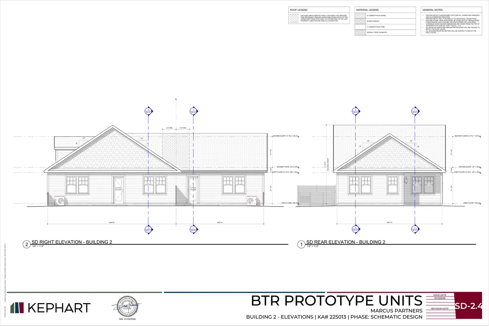
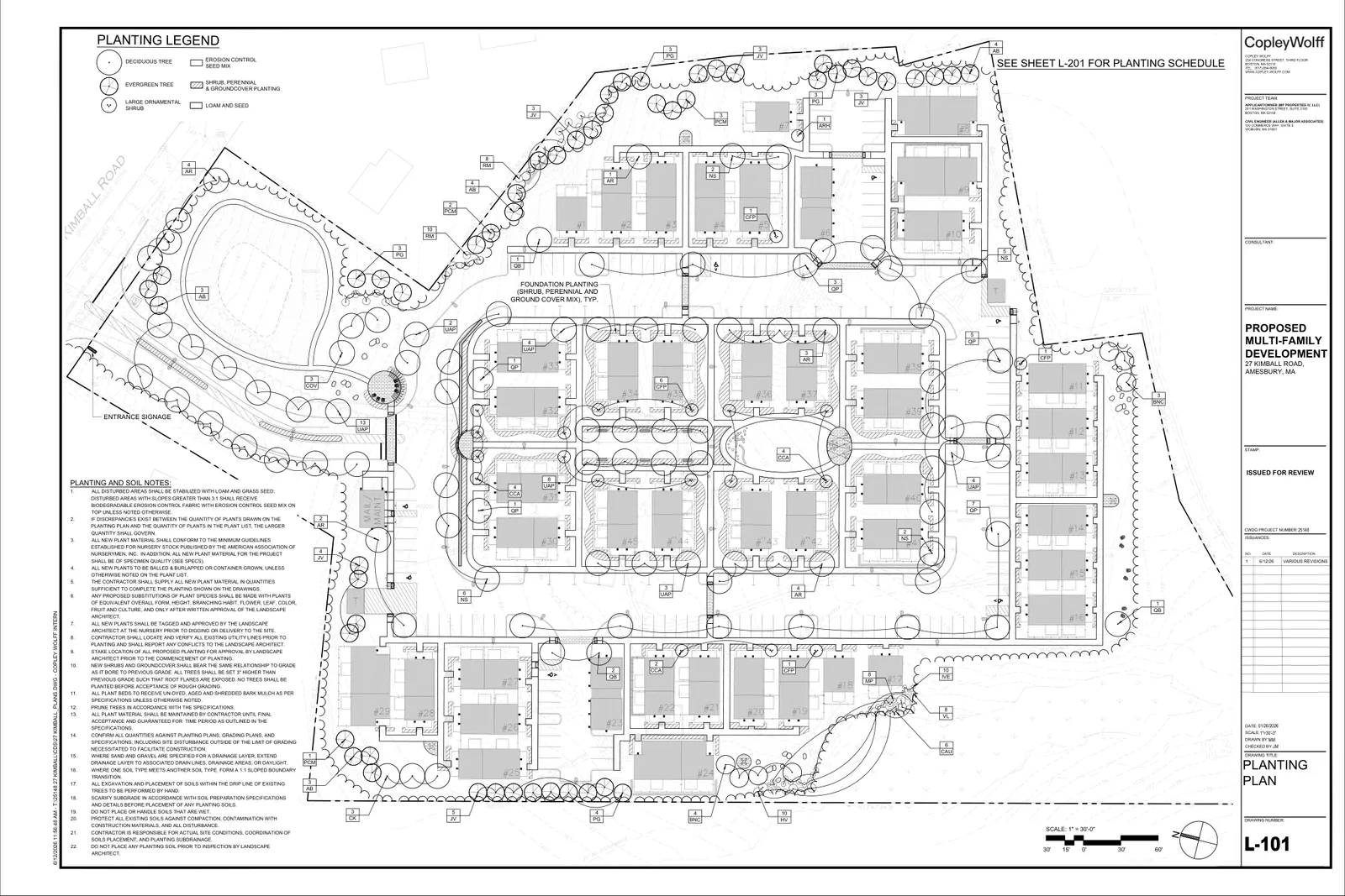
The submitted architectural materials show traditional gabled roofs, porches and horizontal and shingle‑style siding (fiber cement and/or vinyl), and indicate private outdoor space for individual units plus common greens. Site engineering documents show surface parking dispersed on the site, stormwater treatment and conveyance infrastructure, and utility connections for municipal water, electric and sewer (the sewer connection is planned to require an on‑site pump station to reach the municipal line).
Where and how big
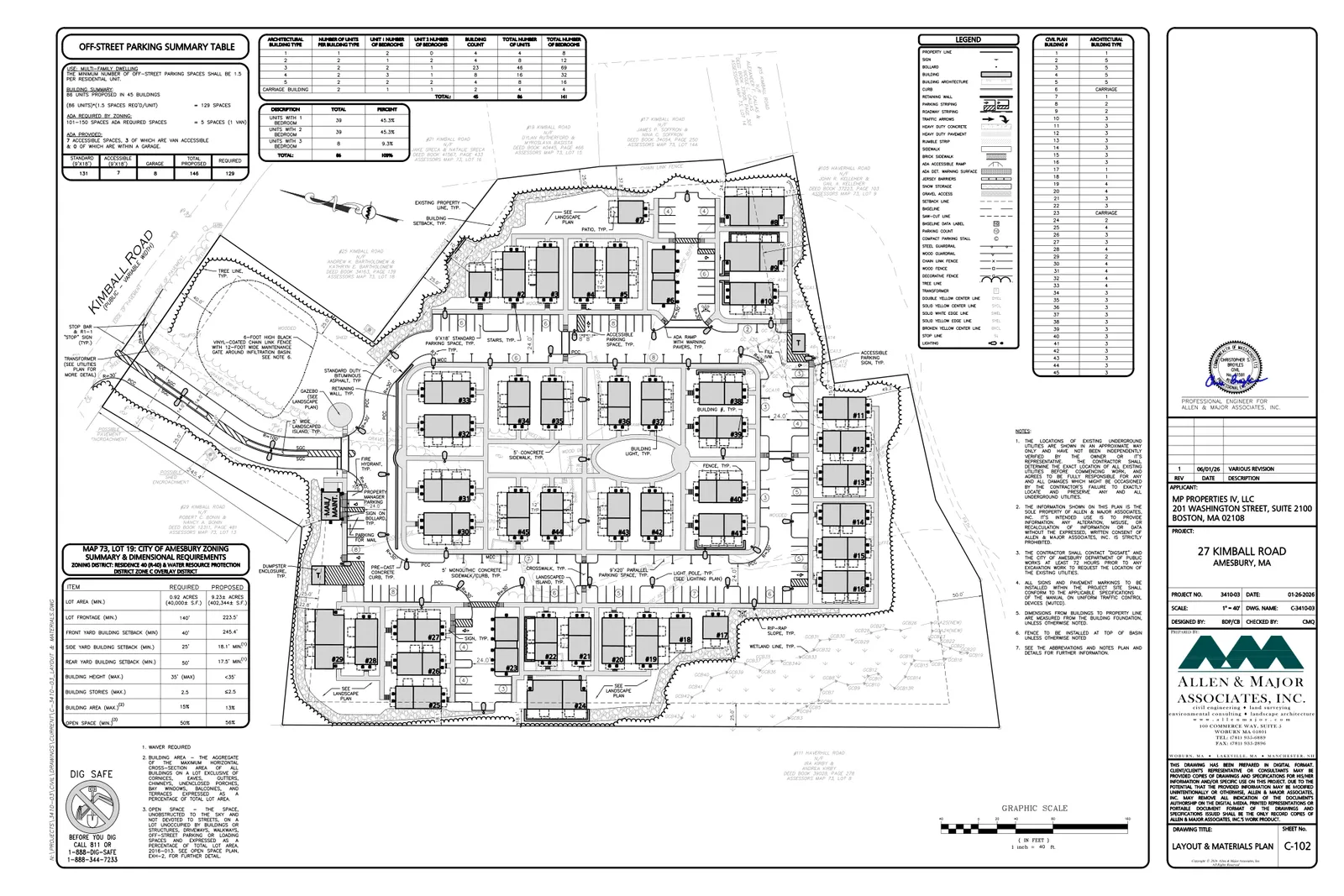
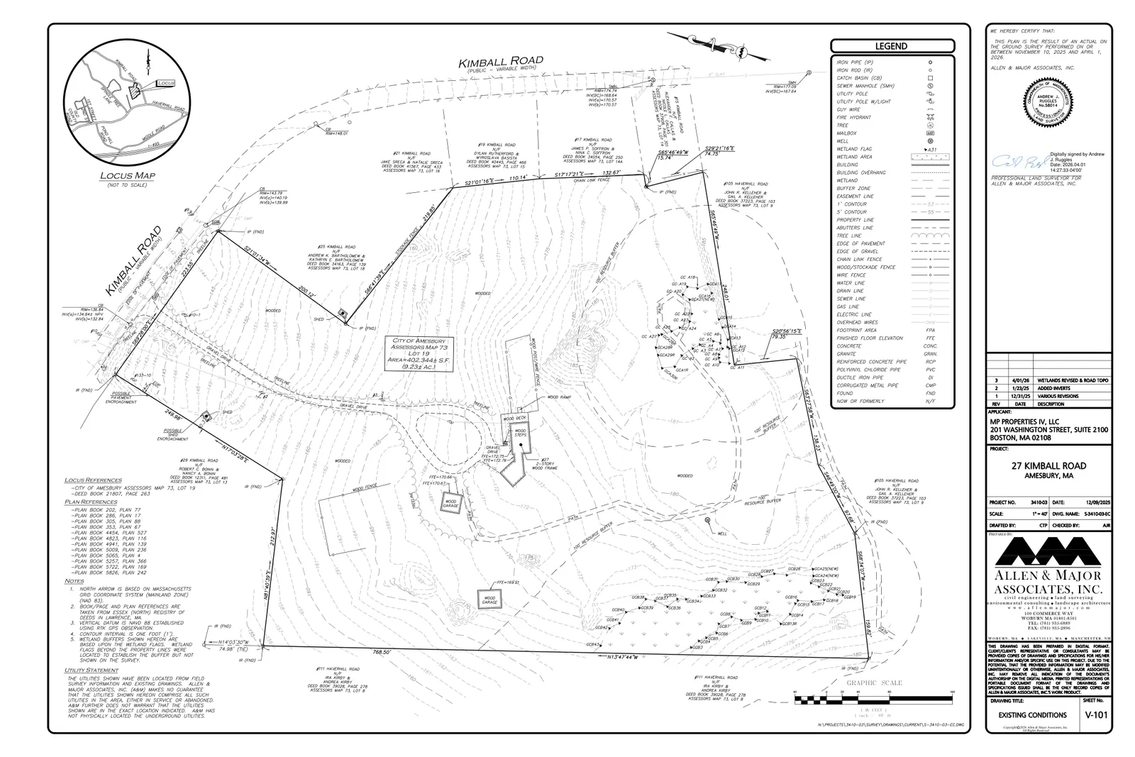
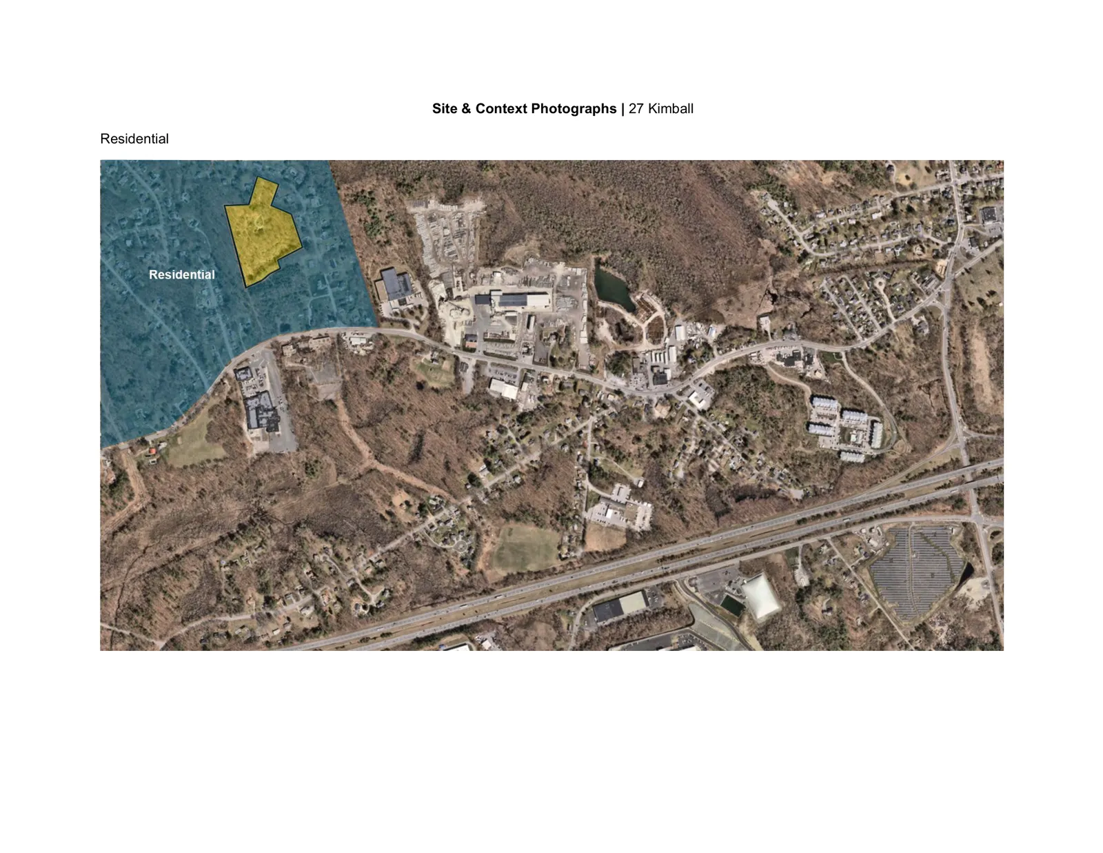
The project parcel is approximately 402,344 square feet (about 9.23 acres) with roughly 223.5 feet of frontage on Kimball Road. Existing site conditions include a two‑story residence, a gravel driveway and accessory structures; topography generally slopes northward. Civil and site development plans provided with the application show building footprints, an internal loop driveway, parking areas, drainage structures, landscaped buffers and delineated wetland resource areas.
The application materials include a full set of site development and architectural plans, a drainage report, a traffic study, wetland delineation (ANRAD) and supporting memos from city departments.
Parking, access and transportation
Vehicular access is proposed from a single curb cut on Kimball Road (civil documents reference a 33‑foot wide drive aisle) with an internal looped driveway to serve site circulation and emergency apparatus. The Fire Chief’s review states the proposed entrance and internal circulation meet minimum fire code access width and that the looped plan provides acceptable apparatus maneuverability; a third‑party fire engineering review is noted as pending.
The project proposes surface parking; the architectural narrative describes a planning ratio of about 1.2 spaces per bedroom rather than a single fixed parking count shown on one plan sheet. The Amesbury Police Department memo raises several traffic and pedestrian safety concerns specific to the Kimball Road corridor, including roadway narrowness, limited sidewalks, the proposed single entrance/exit, the entrance’s proximity to a curve, and impacts at the nearby Route 110 intersection. The application includes a Traffic Impact and Access Study for review by the ZBA and city staff.
Natural resources, stormwater and utilities
Wetlands and permitting: an Abbreviated Notice of Resource Area Delineation (ANRAD) was filed and approved following peer review. The Conservation Commission memo identifies a Bordering Vegetated Wetland (BVW) on the southern portion of the site that is jurisdictional under the Massachusetts Wetlands Protection Act (WPA) and Amesbury local regulations; any work affecting that BVW will require a Notice of Intent (NOI) to the Conservation Commission. An Isolated Vegetated Wetland (IVW) on the eastern portion of the property is regulated locally but not jurisdictional under the WPA; the Conservation Commission asked that the IVW be re‑evaluated for vernal pool characteristics. (Technical note: an ANRAD is a filing used to confirm wetland boundaries; a NOI is the filing used to request permission to alter jurisdictional wetland resource areas; an Order of Conditions is the permit decision issued by the Conservation Commission following NOI review.)
Stormwater and drainage: the drainage report prepared by Allen & Major Associates (issued 1/26/2026; revised 6/1/2026) describes a stormwater management system that uses deep‑sump catch basins, proprietary separators, underground detention/infiltration systems and an infiltration basin. The report analyzes pre‑ and post‑development runoff at multiple study points and states that the proposed system is designed to meet MassDEP Stormwater Management Standards, provide water‑quality treatment, recharge groundwater where appropriate and reduce peak runoff at the analyzed discharge points. The submission includes an Operations & Maintenance (O&M) plan for long‑term maintenance of stormwater controls.
Utilities: plans indicate connection to municipal water and electric services and to municipal sewer via a pump station. The project materials note utility coordination is required for those connections.
Status and next steps
The Comprehensive Permit application is under review by the Amesbury Zoning Board of Appeals. Key departmental comments and procedural items on file include: the Conservation Commission’s ANRAD approval and request for further IVW evaluation; the Fire Chief’s memo indicating the access meets minimum code requirements with a third‑party fire review in progress; and the Police Department memo expressing traffic and pedestrian safety concerns specific to Kimball Road. The Inspectional Services department provided an initial memo noting no concerns at that review stage but said issues could arise closer to construction.
Under local and state procedures, the applicant will need to address Conservation Commission permitting if work will affect the jurisdictional BVW (an NOI and subsequent Order of Conditions would be required). The ZBA will consider the Comprehensive Permit application and any requested local zoning waivers; residents and abutters may follow ZBA and Conservation Commission agendas and public hearings for updates, additional submittals, peer review reports (traffic, fire, wetlands, stormwater) and formal decisions or permit conditions.
Discussion at meetings
- APPROVEMotion to approve the ANRAD subject to those conditions.
- CONTINUEMotion to continue ANRAD 002-1361 to April 6th.
- APPROVEI move that we use Weston and Sampson.
- CONTINUESo in this second matter, we will continue until March.
- OTHERI move that we require a peer review for the ANRAD at 27 Kimball Road.
- CONTINUEMotion to continue this hearing until our February meeting.
Documents on file


