
8 Noel St - Request for Determination
An RDA filed August 12, 2025 asks the Amesbury Conservation Commission to confirm that a man‑made 26,000‑sf stormwater basin at 8 Noel Street is not a jurisdictional wetland.

AI summary
An RDA filed August 12, 2025 asks the Amesbury Conservation Commission to determine whether a man‑made stormwater basin (about 26,000 sq ft) at 8 Noel Street is a jurisdictional wetland under state or local law. The basin has earthen berms, a 36‑inch CMP outlet, and is dominated by invasive Phragmites; no construction is proposed in this filing. A public hearing was scheduled for September 2, 2025, and the Commission will decide whether the basin is jurisdictional or not, with any regulated remediation work to follow via a Notice of Intent if required.
Gallery
Project details
What is proposed
A Request for Determination of Applicability (RDA) was submitted asking the Amesbury Conservation Commission to determine whether a man‑made stormwater basin at 8 Noel Street is a jurisdictional Wetland Resource Area under the Massachusetts Wetlands Protection Act (M.G.L. c.131, §40) or the City of Amesbury Wetlands Protection Ordinance. The filing was prepared by LEC Environmental Consultants, Inc., on behalf of Boston Gas Company and was submitted on August 12, 2025. No construction work is proposed as part of this RDA.
Where and how big
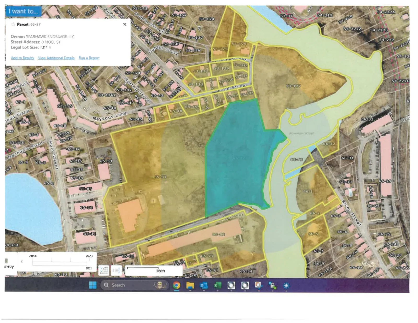
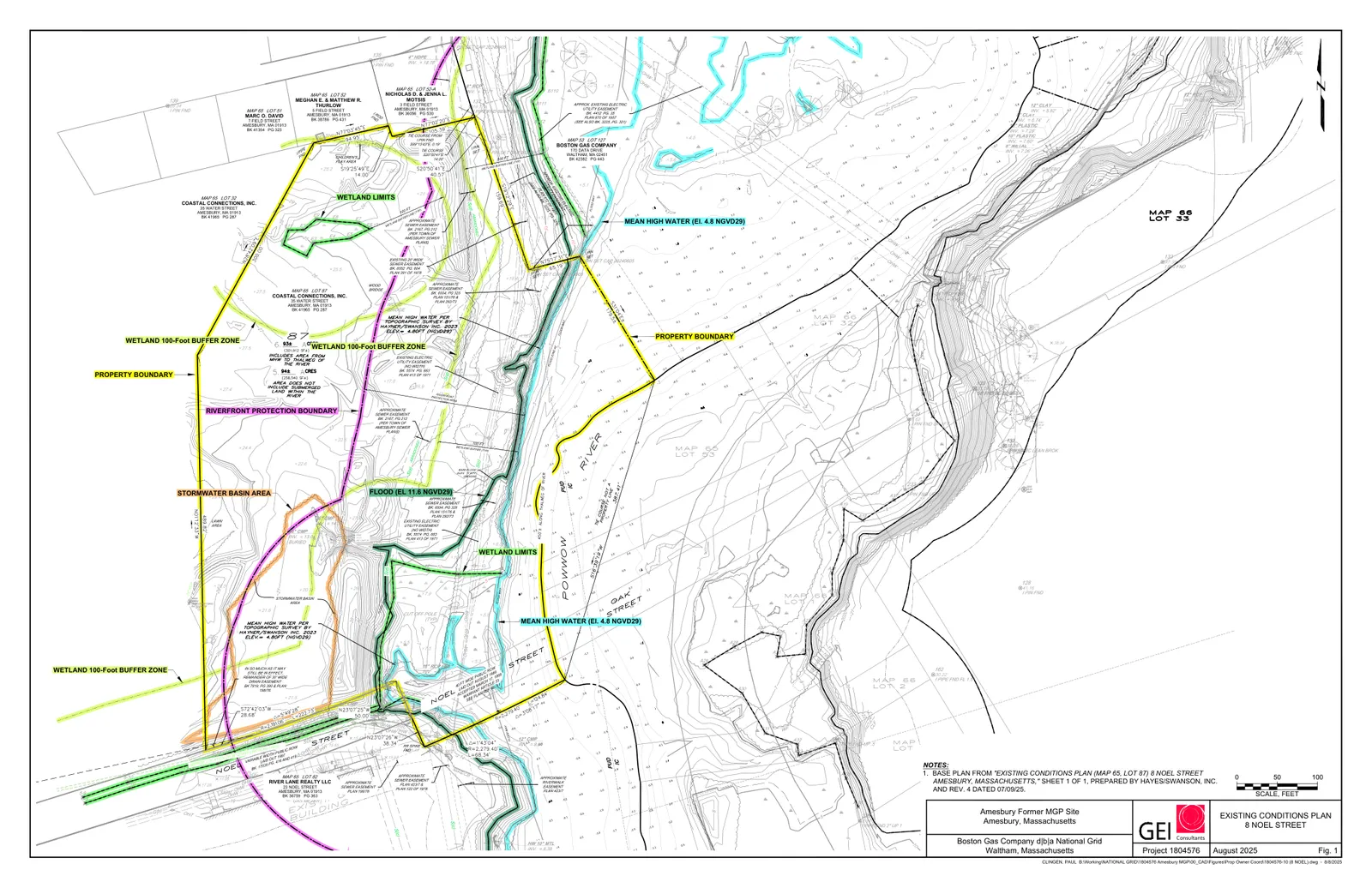
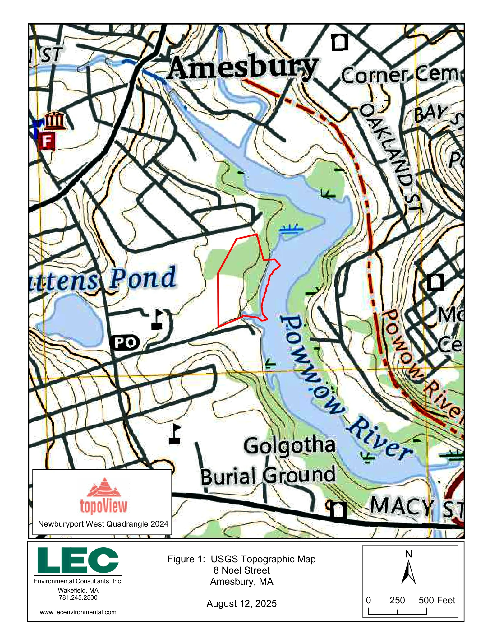
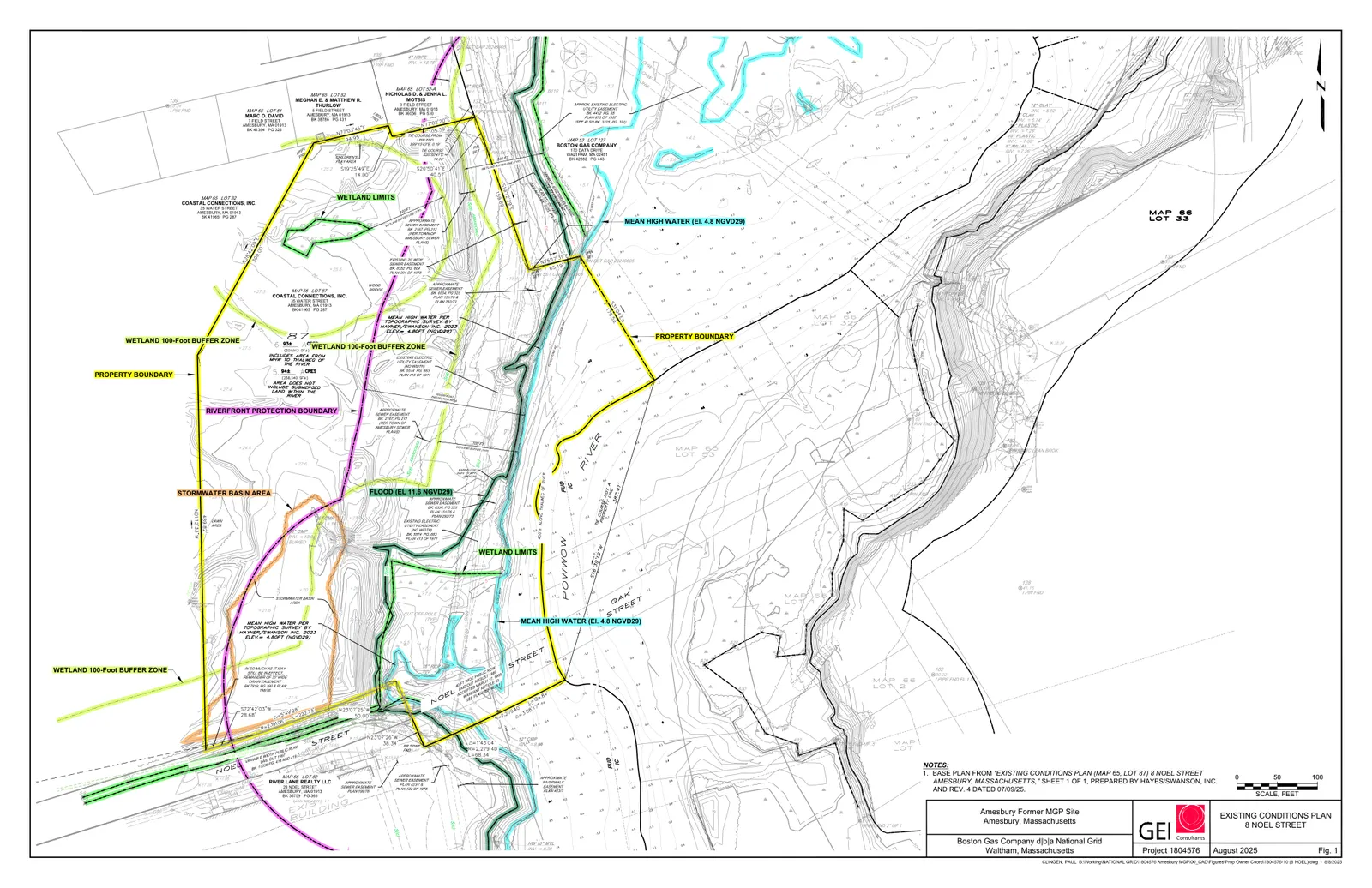
The parcel is at 8 Noel Street (Assessor Map 65, Lot 87) in Amesbury, adjacent to the Powwow River. The RDA and attached Existing Conditions Plan (GEI Consultants, dated August 8, 2025) show the basin located mostly within the Riverfront Area of the Powwow River. The stormwater basin is described in the filing as approximately 26,000 square feet in area.
Existing conditions and technical details
Field work for a wetland delineation was performed on June 13, 2024. The parcel contains multiple wetland resource areas identified in the filing: Bordering Vegetated Wetland (BVW), Isolated Vegetated Wetland (IVW), Bank/mean annual high water, Riverfront Area, and Bordering Land Subject to Flooding (BLSF). The stormwater basin is a man‑made earthen depression with distinct berming: the easterly berm is reported as about 4 to 7 feet high and the north, west, and south sides have smaller man‑made slopes of about 2 to 5 feet.
The basin outlet is an opening in the easterly berm fitted with a 36‑inch diameter corrugated metal pipe (CMP) that is partially buried and clogged with sediment; that outlet conveys stormwater east into a shallow man‑made ditch, then into a BVW and the Powwow River. Vegetation in the basin is described as a dense monoculture of common reed (Phragmites australis), a non‑native invasive wetland grass. The filing notes the basin receives stormwater inputs and displays wetland hydrology in places, and states that the influence of groundwater on basin hydrology is unknown.
For clarity: a Request for Determination of Applicability (RDA) asks the Conservation Commission to say whether a specific area or activity is subject to the Wetlands Protection Act or local wetland regulations. A Negative Determination would mean the Commission finds the area or activity is not subject to jurisdiction; a Positive Determination would mean it is jurisdictional and would typically require a Notice of Intent (NOI) for regulated work. A Notice of Intent is the formal wetlands permit application that, if approved, results in an Order of Conditions (the permit specifying allowed work and required protections).
Regulatory context and the applicant's position
The RDA cites the 2014 DEP regulatory revision (310 CMR 10.02(2)(c)) that excludes stormwater features designed and installed after November 18, 1996 from creating jurisdictional resource areas; because the basin predates that date (the filing states it was likely constructed in the late 1960s), the applicant asks the Commission to consider pre‑1996 stormwater features on a case‑by‑case basis. The filing characterizes the feature as a stormwater management basin that continues to function for stormwater control and as being in need of maintenance rather than as a natural wetland Resource Area. Based on that analysis, the applicant requests a Negative Determination for the basin.
The RDA also notes that Boston Gas Company plans remediation work in the Powwow River related to the former Amesbury Manufactured Gas Plant (MGP) site and that parts of 8 Noel Street may be used for equipment laydown; the filing states that any remediation or related construction that falls within the Commission’s jurisdiction will be addressed through a future comprehensive Notice of Intent.
Status and next steps
The RDA application package includes the Existing Conditions Plan (GEI, August 8, 2025), site figures (USGS topo, MassGIS orthophoto, FEMA map), and affidavits of service and abutter notification dated August 13, 2025. The RDA materials indicate the City filing fee was mailed. A public hearing before the Amesbury Conservation Commission is listed for September 2, 2025 at 6:30 p.m. (to be conducted remotely with public notice). At the hearing the Commission will review the RDA and supporting materials and issue a determination: a Negative Determination would find the basin is not jurisdictional under the Act or local ordinance; a Positive Determination would identify the basin or portions of it as jurisdictional and would require subsequent permitting (for example, an NOI) for regulated work. The Commission’s determination and any subsequent filings are the next formal steps in the process.
Discussion at meetings
- APPROVEI will in that case entertain a motion to find in the negative that is to say that this is not jurisdictional
- CONTINUEI'll entertain a motion to continue this until our October meeting,


