
4 Lake Attitash Road - Notice of Intent

Gallery
Project details
What is proposed
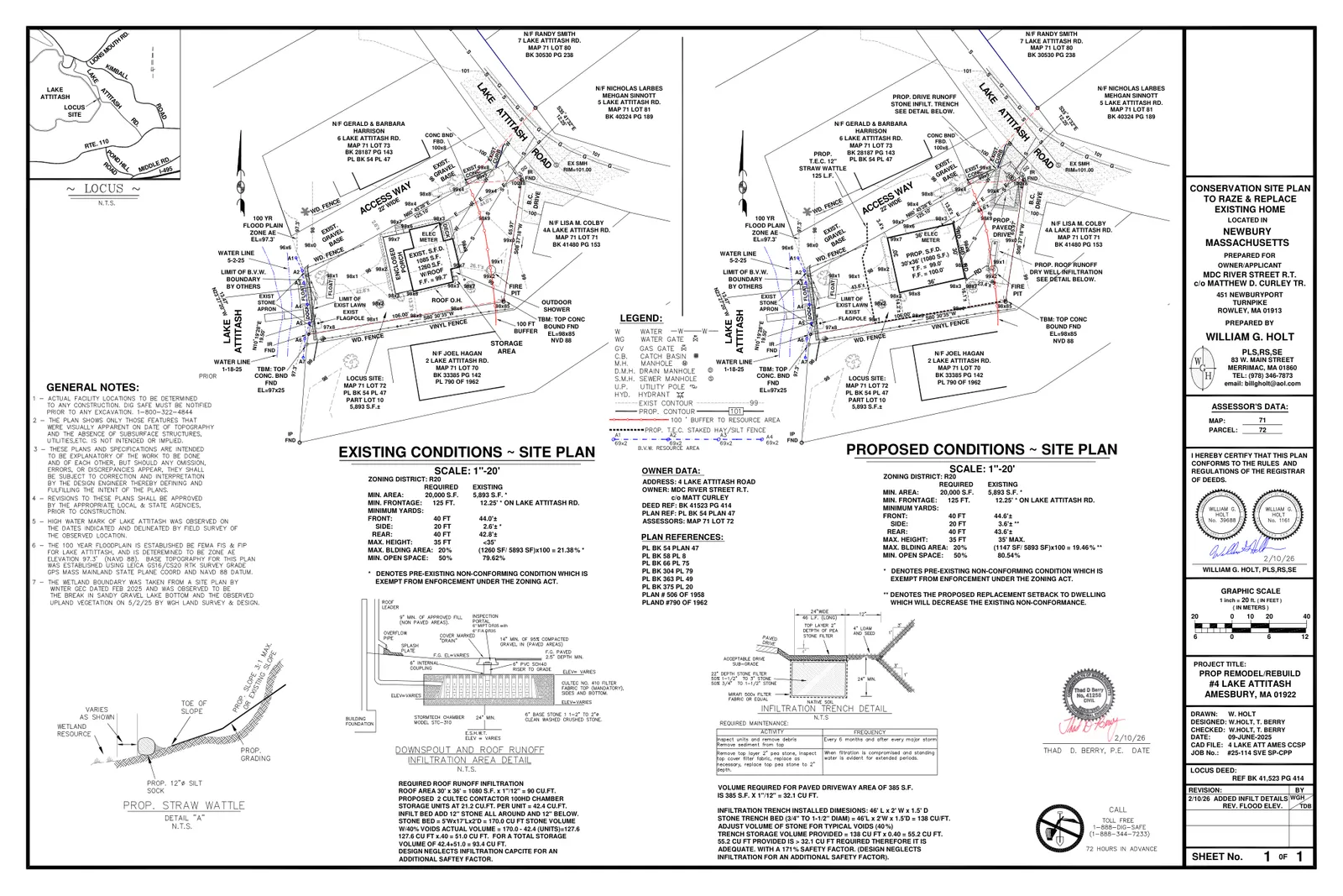
The applicant proposes to raze the existing single‑family dwelling at 4 Lake Attitash Road and construct a replacement single‑family home on approximately the same footprint. The submission is a Notice of Intent (NOI) under the Massachusetts Wetlands Protection Act; an NOI is the formal application that initiates Commission review of work proposed in or near wetland resource areas.
The work includes reconnecting to existing municipal utilities (water, sewer, electric), creating a single dedicated on‑lot parking space at the front of the property, and installing on‑site infiltration systems (chamber units and stone infiltration trench) to capture and infiltrate the first inch of roof and parking area runoff.
Where and how big
The property is shown as Assessors Map 71, Lot 72 with a lot area of about 5,893 square feet. The existing dwelling is described in the filing as approximately 1,085 square feet of building area with an existing impervious roof area reported at about 1,260 square feet. The proposed replacement dwelling footprint is shown as 30' x 36' (1,080 square feet); the filing uses a roof area of about 1,080 square feet for stormwater calculations.
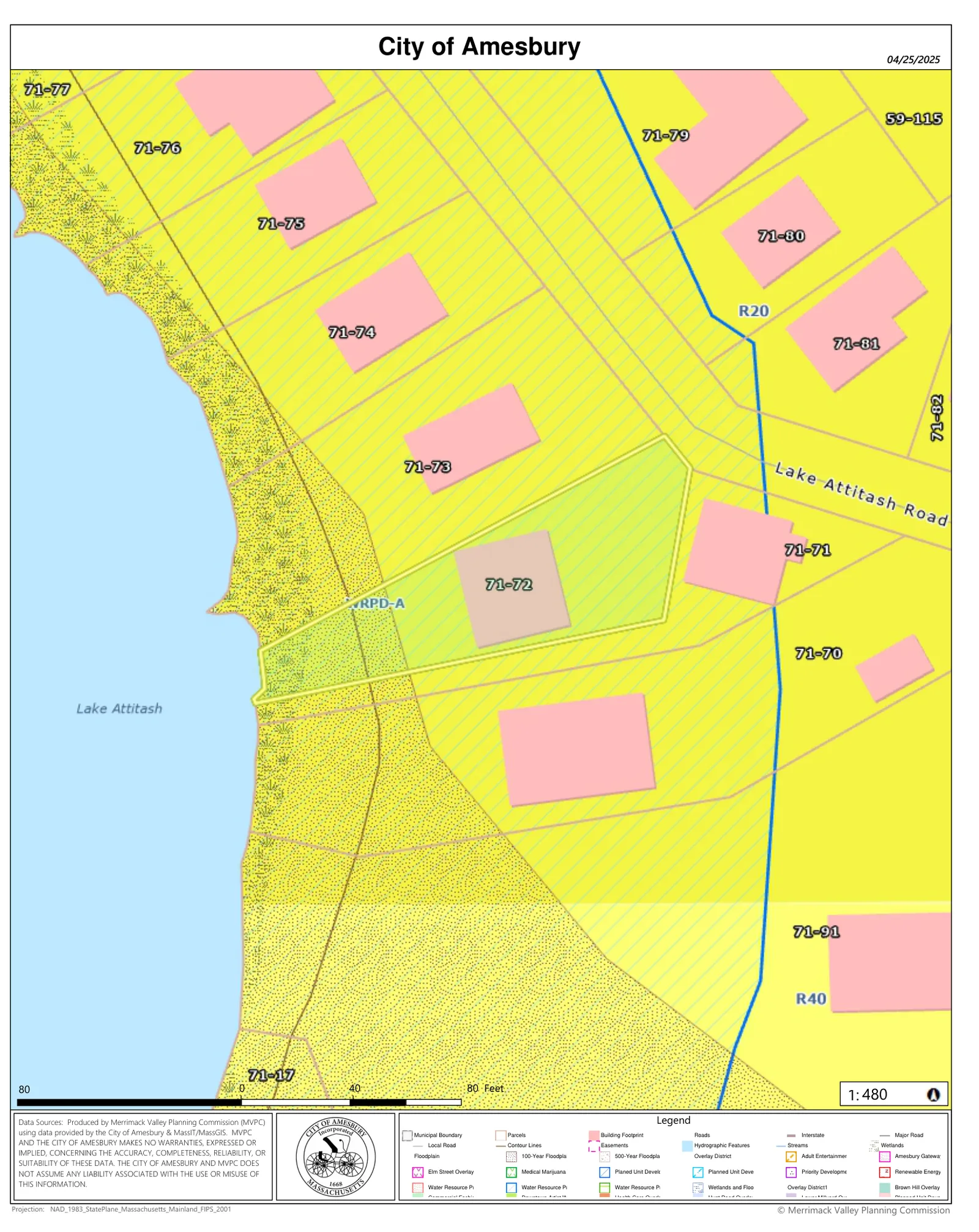
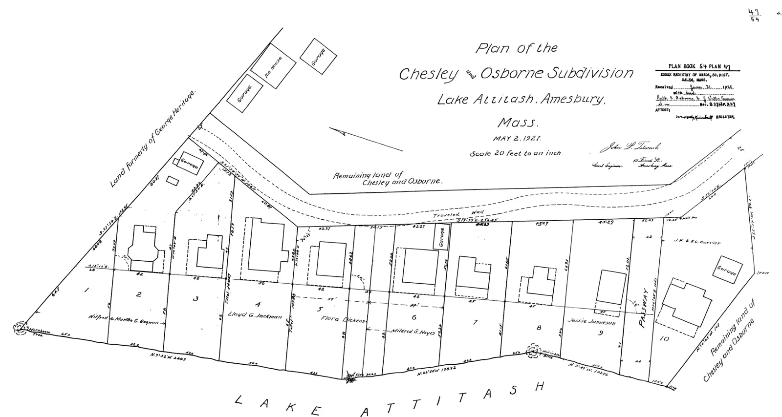
The lot has about 32.97 feet of lake shoreline frontage and roughly 12.25 feet of frontage on Lake Attitash Road. The parcel is a pre‑existing nonconforming lot in the R20 zoning district (required lot area 20,000 sq ft; required frontage 125 ft). The applicant reports only minimal proposed grade changes (0.1–0.3 feet) and intends to locate the new structure in the same general position as the existing house.
Parking, access and stormwater
Access to the site is from Lake Attitash Road and a 22‑foot‑wide private right‑of‑way adjacent to the property. There is currently no formal on‑lot parking; the proposal establishes a paved one‑car parking area of about 234 square feet located outside the 100‑foot wetland buffer.
Stormwater management described in the filing includes collection of roof runoff by gutters and downspouts and routing to subsurface infiltration chambers and a stone infiltration bed sized to retain the first 1 inch of runoff. The submission specifies two Cultec Contactor 100HD chambers (21.2 cubic feet storage per unit; 42.4 cu ft total) combined with a stone bed to provide a reported total storage capacity of approximately 93.4 cubic feet for roof runoff. A stone infiltration trench for the parking area is shown as 46 feet long × 2 feet wide × 1.5 feet deep; the plan reports an effective storage volume after void adjustments of about 55.2 cubic feet. The design approach described in the materials states the first inch of runoff is expected to drain within 24 hours after completion of a rainfall event (the design model conservatively neglects native infiltration rates to provide a safety factor).
Wetlands, floodplain and erosion control
Wetland flags A1–A7 delineate the border of the lake bank BVW (Bordering Vegetated Wetland) adjacent to the property; those boundaries were originally delineated by Winter GEC (February 2025) and are shown on the submitted plans. The proposed construction and associated disturbance are confined to upland areas within the 100‑foot buffer to the BVW; no work is shown inside the BVW.
The applicant estimates temporary disturbance within the 100‑foot buffer at about 3,598 square feet. The plans show the FEMA 100‑year (Stillwater) flood elevation for Lake Attitash as 97.3 feet (NAVD 1988); the filing reports the lowest adjacent grade near the house at about 98.3 feet and states no loss of floodplain storage volume is proposed.
The NOI describes standard erosion and sediment controls and construction best management practices (BMPs) to be used during construction, including silt fence, staked straw bales or straw wattles, protected stockpiles, use of a Dandy bag or similar sediment control for dewatering, fuel spill absorbents and that equipment staging and refueling will occur outside the 100‑foot buffer or in a designated protected area. Final restoration measures described include replacing topsoil, seeding, and stabilization with mulch or jute matting on slopes steeper than 3:1.
(For clarity: a Bordering Vegetated Wetland, or BVW, is a freshwater wetland type regulated under the Wetlands Protection Act; the 100‑foot buffer is the adjacent upland area in which activity is regulated. An "Order of Conditions" is the permit the Conservation Commission issues that specifies allowed work and required protective measures.)
Status and next steps
The NOI package was transmitted to the Amesbury Conservation Commission and to MassDEP in February–March 2026; the NOI Wetland Fee Transmittal indicates a total filing fee of $500 was paid. As a Notice of Intent, the application will be reviewed at a public hearing by the Conservation Commission. The Commission may request additional information, require changes to plans or mitigation measures, and will ultimately issue an Order of Conditions (a wetlands permit) that sets conditions for construction and site stabilization if the project is allowed to proceed.
City records or the Commission’s meeting agenda and minutes will show the current procedural status (such as whether a hearing has been scheduled, whether the filing is complete, and whether any site visits or required agency mailings have been completed).
Discussion at meetings
- CONTINUEContinue the public hearing for 4 Lake Attitash Road (NOI 002-1364) to October 5, 2026.
- CONTINUEContinue the NOI for 4 Lake Attitash Road (NOI 002-1364) to the September meeting.


