
25 Cedar Street - Notice of Intent
Notice of Intent for stormwater and roof‑drainage improvements at the Lofts at Clark’s Pond (15 & 25 Cedar St) with temporary disturbance in FEMA Zone A and the 100–200 ft Riverfront Area and an Order of Conditions issued August 4, 2025.

AI summary
The Lofts at Clark’s Pond Homeowner Association filed a Notice of Intent to replace and reconfigure roof drainage at Building #2 (15 & 25 Cedar St) to address repeated flooding at a north entrance and adjacent parking areas. The proposal installs new 6" and 12" PVC roof drains, ties into the existing on‑site stormwater system and vortex treatment units, and includes temporary disturbance in the FEMA Zone A/BLSF and the 100–200 ft Riverfront Area (no permanent wetland fill). The Conservation Commission issued an Order of Conditions (recorded August 4, 2025); construction was targeted for late summer/fall 2025 with completion expected by spring 2026.
Gallery
Project details
What is proposed
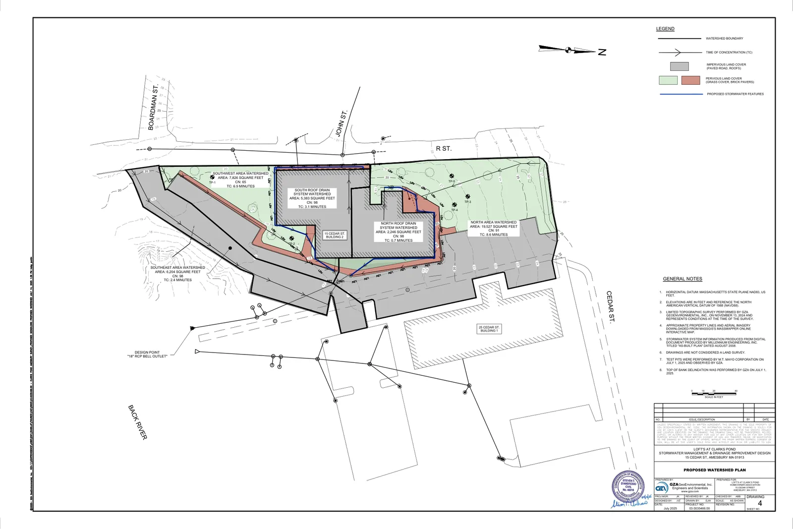
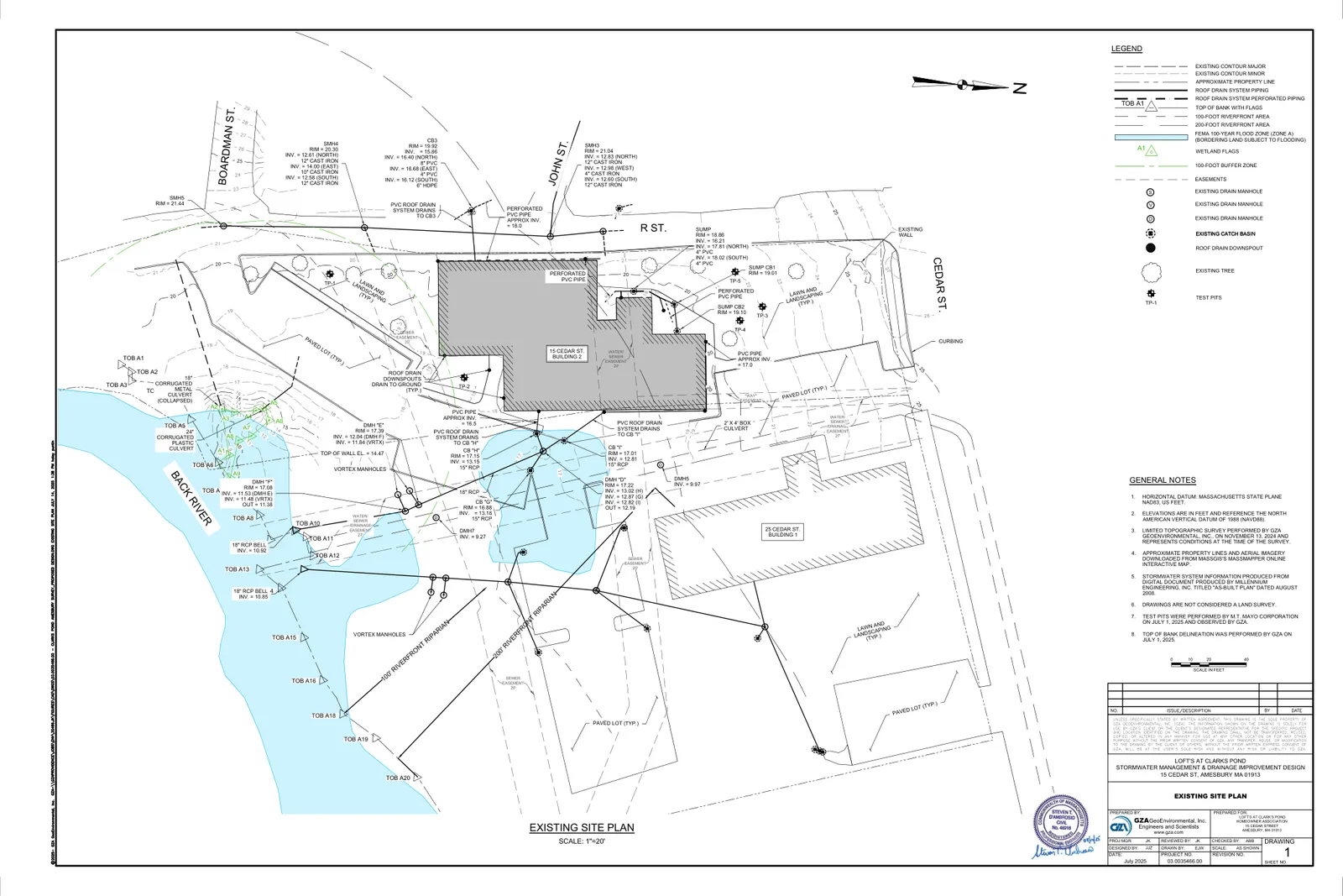
The Lofts at Clark’s Pond Homeowner Association filed a Notice of Intent for stormwater management and drainage improvements at 15 & 25 Cedar Street. The work replaces and reconfigures the roof drainage for Building #2 to prevent ponding and interior flooding at the building’s north entrance and to reduce inundation in adjacent parking and walkways. Work includes removal of existing perforated roof drain piping, installation of new solid PVC roof drainage (6" and 12" sizes shown on the plans), trenching and backfilling, tie‑ins to existing manholes/catch basins, capping the existing discharge to R Street, selective replacement of brick pavers, and site restoration.
Where and how big
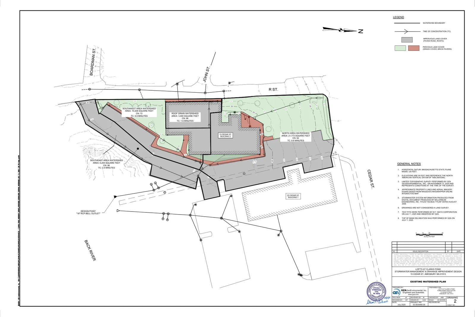
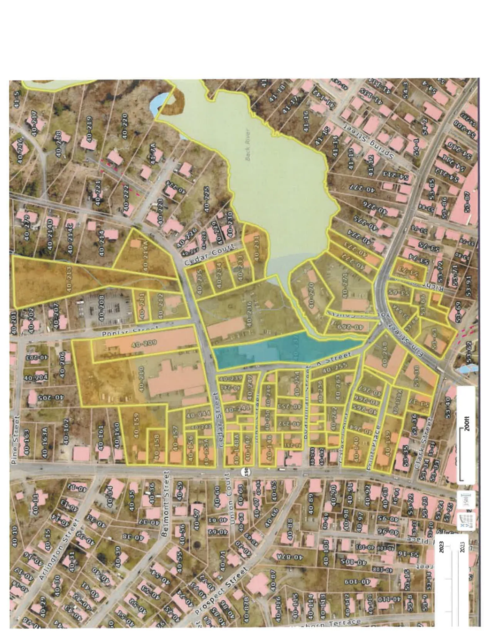
The site consists of two residential buildings, associated parking, and landscaped areas bounded by Cedar Street, R Street, and the Back River. The north roof system will collect six existing roof drains conveyed by a proposed 12‑inch PVC pipe to an on‑site catch basin; the south roof system will collect five roof drains conveyed by a proposed 6‑inch PVC pipe to another on‑site catch basin. Both systems connect into the existing 18" reinforced concrete pipe outfall and pass through existing vortex water‑quality units before discharging to the Back River. The project does not add impervious area.
Wetlands, floodplain and technical considerations
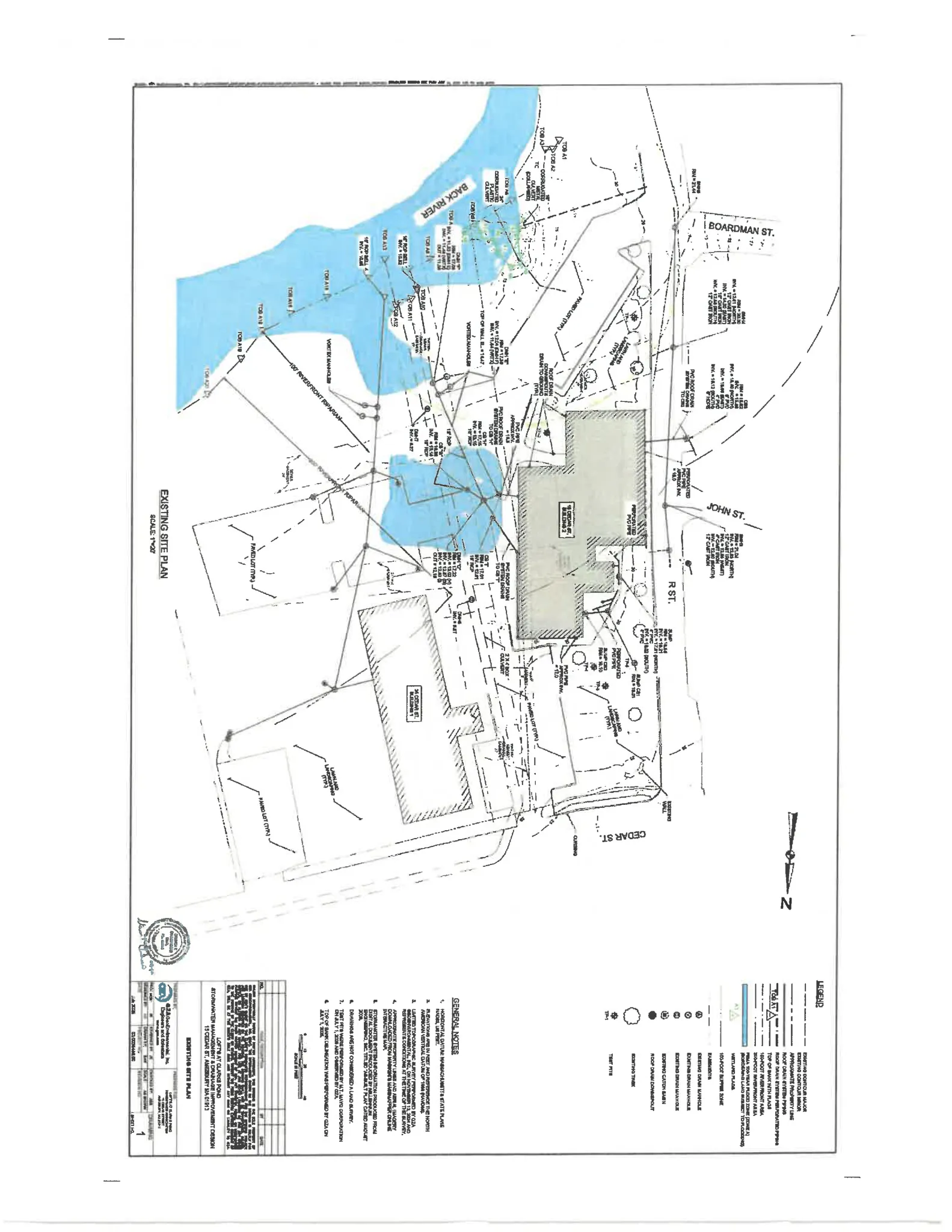
GZA completed a wetland delineation and test pits (July 1, 2025). The Back River was treated as a perennial stream with a 200‑foot Riverfront Area; proposed activities are limited to the outer riparian zone (100–200 ft) and previously developed areas. Portions of the site fall within FEMA Zone A (100‑year floodplain) and the BLSF impact area shown on the plans. The application reports temporary disturbances of ~145 sf in the 100‑foot buffer zone, ~1,142 sf in BLSF (FEMA Zone A), and ~4,715 sf in the 100–200 ft Riverfront Area; no permanent loss of flood storage, BVW or bank is proposed.
Subsurface test pits identified urban fill/udorthents and seasonally shallow groundwater near the building; because of these conditions, on‑site infiltration for roof runoff was evaluated and dismissed as not practicable under MassDEP guidance. The existing perforated pipes previously routed roof runoff for infiltration; the project replaces or removes those pipes and routes roof runoff into the on‑site conveyance and existing vortex treatment units. Vortex catch basins (noted in the plans) are devices used on site to capture and retain trash, debris and sediment and to improve water quality prior to discharge.
Hydrologic and hydraulic modeling (HydroCAD) was provided in the stormwater report: modeled peak flows at the Back River show only minimal change between pre‑ and post‑construction conditions (for example, 2‑yr event 2.03 → 2.07 cfs). The existing 18" RCP outfall is protected with riprap; outlet protection was evaluated and found adequate for the modeled conditions.
Construction practices and schedule
Planned construction measures include limits of disturbance, downgradient filter sock (or equivalent) around trenching, catch basin inlet protection, temporary sediment controls for stockpiles, weekly and post‑storm inspections, spill absorbents on site, and final stabilization and seeding (seeding window noted April 15–September 15). The applicant targeted a late‑summer/early‑fall 2025 start with completion in 2025 or by spring 2026, pending permit timing.
Status and documentation
The Notice of Intent and supporting materials (WPA Form 3, wetland delineation, stormwater management report with modeling and test‑pit logs, and site drawings) were prepared by GZA GeoEnvironmental, Inc. on behalf of the Lofts at Clark’s Pond Homeowner Association. The Amesbury Conservation Commission reviewed the filing and the Commission’s record shows an Order of Conditions (final issuance recorded August 4, 2025).
Discussion at meetings
- APPROVEApprove NOI and issue Order of Conditions for 15 Cedar Street (DEP 002-1351)
- OTHERClose the hearing for the 15 Cedar Street NOI
Documents on file


