
2 Merrimac St. - Special Permit
A redevelopment of the former Larry’s Marina at 2 and 13 Merrimac Street proposing a new elevated restaurant, a two-story marina operations building, parking, boardwalk and stormwater improvements, approved by the Planning Board with conditions on 9/23/2024.

AI summary
The Marina at Amesbury Point redevelopment proposes demolishing several existing marina structures and constructing a new elevated restaurant and a two-story marina operations/members’ club building at 2 Merrimac Street, with use of 13 Merrimac Street for additional parking. The project includes site amenities (boardwalk, patios), stormwater controls (catch basins, a Contech CDS unit, and a rain garden), and was granted Site Plan Review and Special Permits by the Amesbury Planning Board on September 23, 2024, subject to conditions and required permits (including wetlands review by the Conservation Commission).
Gallery
Project details
What is proposed
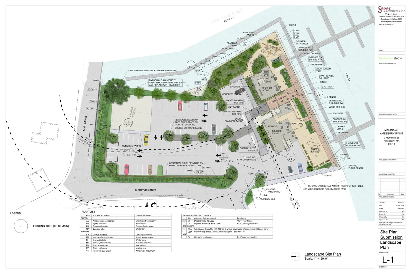
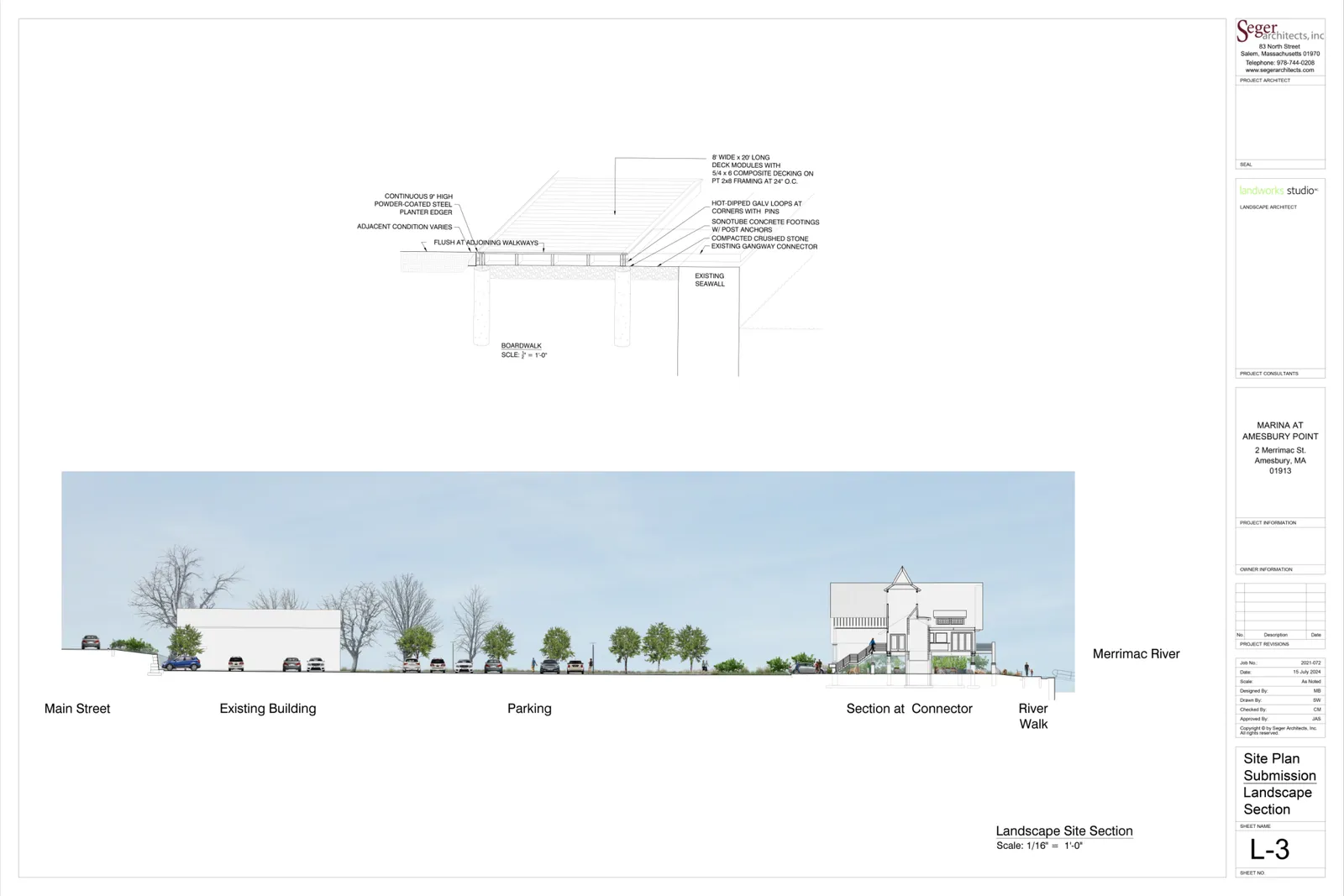
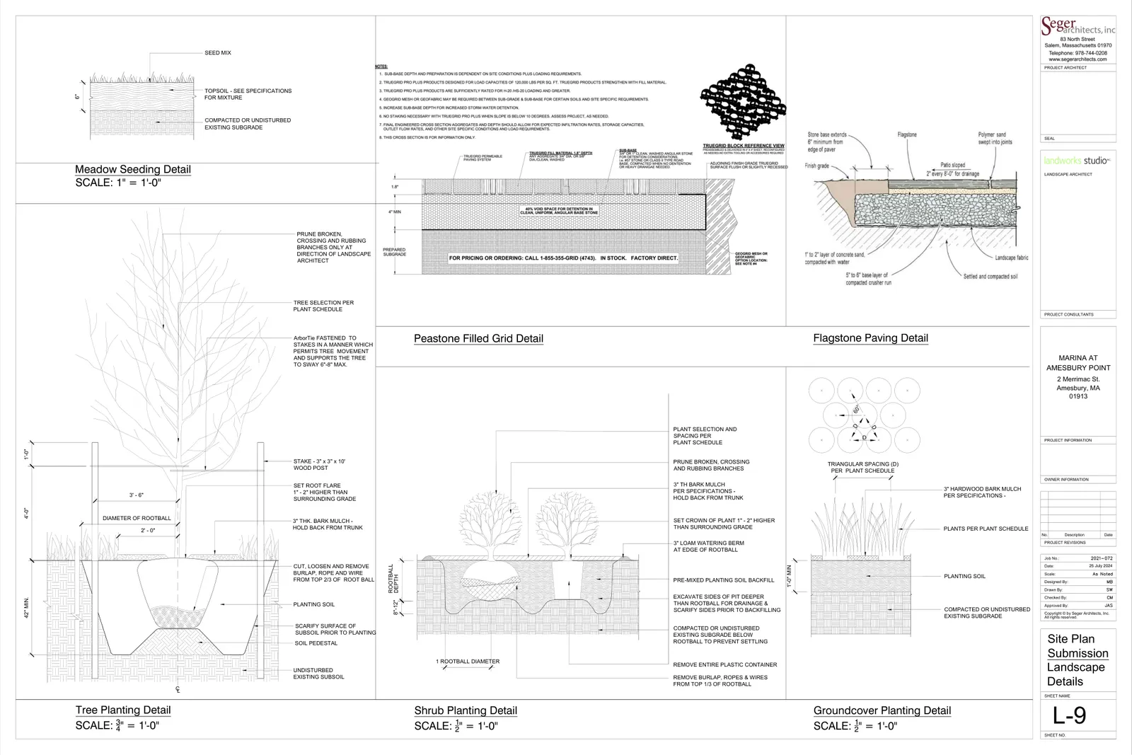
The applicant (14 Merrimac Street LLC) proposes to redevelop the marina property at 2 Merrimac Street (with use of the adjacent 13 Merrimac Street parcel for parking). The proposal includes demolition of several existing marina structures, renovation of one smaller on-site building, construction of a new one-story elevated restaurant and a new two-story marina operations / members’ club building, and associated site improvements such as landscaping, outdoor dining decks, a boardwalk along the river, and a loading/service area.
The restaurant is reported on application materials as 3,796 square feet gross floor area (the Planning Board decision references approximately 4,700 square feet in its findings). The marina operations building is shown as roughly 2,537 square feet in the application, with a second-floor office area of about 500 square feet and an overall height recorded near 32 feet; the first floor is proposed to be elevated about six feet above grade to address floodplain conditions.
Where and how big
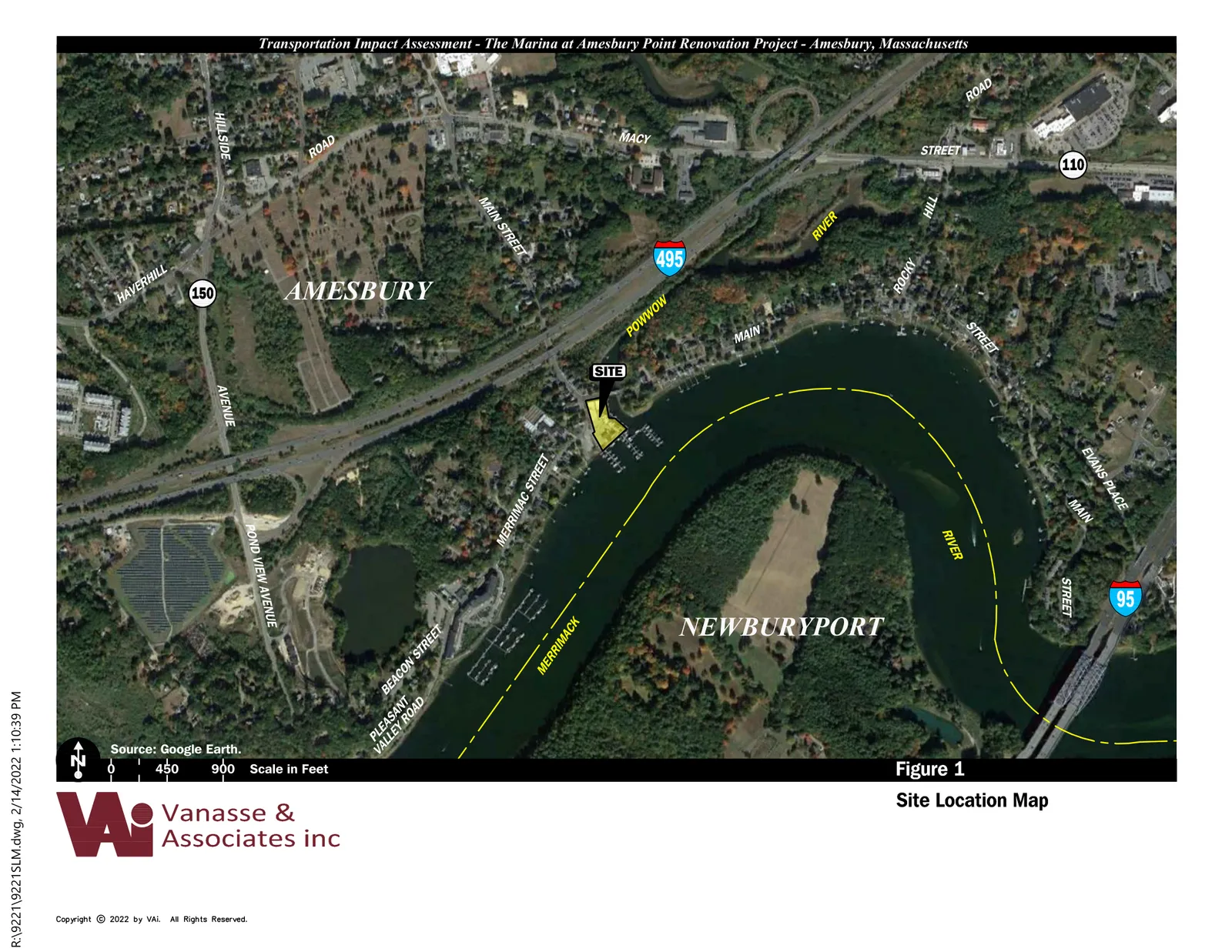
The project parcels are on Assessors Map 88 (Lots 1 and 82). The primary parcel (2/14 Merrimac Street) is approximately 70,903 square feet (about 1.55 acres). The adjacent parcel at 13 Merrimac Street is about 18,281 square feet (about 0.42 acres) and is shown in the plans as parking available for marina patrons and staff.
Site topography reported in the engineering materials ranges from about 21.0 feet at the northwest end to about 7.0 feet at the southeast end (survey datum noted). Much of the lot was shown to contain historic fill; soils mapping and test pits indicate C/D soils and engineered fill across much of the site. Large portions of the property are inside the 100-year floodplain and riverfront/wetland buffer areas.
Parking, access and transportation
Vehicular access will remain from Merrimac Street with a formalized curb cut and site entrance. The submitted site plans and parking exhibits show a parking layout to serve the restaurant and marina uses. Project materials include two reported parking totals: a site plan sheet lists 97 parking spaces provided for the development, while the Planning Board decision describes an on-site count of 81 spaces plus 18 spaces on the adjacent parcel (a total of 99). The application requested a waiver for the number of off-street parking spaces relative to zoning requirements.
The plan includes a designated loading/service area at the west side of the restaurant and a drop-off area for events or restaurant access. A Transportation Impact Assessment and subsequent updates were submitted; the Planning Board’s decision records the Board’s finding that the submitted traffic evidence indicated the proposed restaurant was unlikely to produce adverse traffic impacts on the neighborhood.
Environmental and stormwater controls
Because the site fronts the Merrimack / PowWow River and lies largely within the 100-year floodplain and riverfront buffer, the application includes measures intended to address water quality, flood elevations, and regulatory requirements for coastal/riverfront sites. The applicant filed a Notice of Intent with the Amesbury Conservation Commission for wetlands and floodplain work (an Order of Conditions is the wetlands permit a Conservation Commission issues under the Massachusetts Wetlands Protection Act).
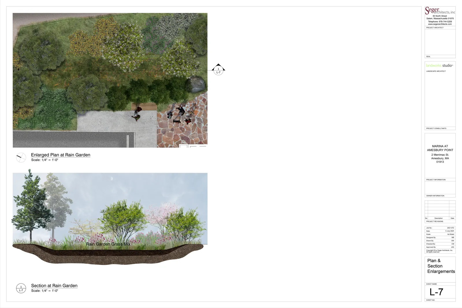
Stormwater design elements shown in the engineering submittals include catch basins, an underground Contech CDS (a proprietary unit that traps oil and sediments prior to discharge), and a planted rain garden. The stormwater report lists total impervious area used in water‑quality calculations as 39,063 square feet, calculates the water‑quality volume target from 1/2-inch of runoff as about 1,625 cubic feet, and reports the rain garden volume below its lowest outlet as about 349 cubic feet; the remaining water quality volume is shown to be provided by the CDS unit per the engineer’s calculations. The report models 2-, 10-, and 100-year storms with HydroCAD and states the design goal of keeping post-development peak runoff rates less than or equal to pre-development rates. The applicant’s stormwater materials also note constraints to infiltration (site soils, fill, and floodplain) and state that recharge is not provided on site to the maximum extent practicable because of those constraints.
Regulatory approvals, waivers and status
The Planning Board received the Site Plan and Special Permit applications on March 11, 2024, held public hearings beginning April 18, 2024, and issued a Final Decision on September 23, 2024. The Board granted Site Plan Review approval and Special Permits for restaurant use, Wetlands and Floodplain District relief, and marina parking, and it approved specific waivers from ordinance provisions where the Board determined the waivers were consistent with regulatory intent and public safety. Conditions and technical performance requirements were included in the Board’s decision.
Additional municipal and state approvals remain part of the implementation path. The project record shows a Notice of Intent filed with the Conservation Commission (which must issue an Order of Conditions — the wetlands permit — addressing work in and near wetlands and floodplain). The project will also require standard building permits, any required utility connections and inspections, and conformity with the Planning Board’s conditions, the conservation permit (Order of Conditions) and other applicable local and state regulations before construction proceeds.
If you want, I can extract and list the Planning Board’s specific conditions and the waivers granted, or provide a plain‑language extract of the stormwater treatment capacities and the parking calculations from the plan set.
Discussion at meetings
- WITHDRAWMotion to accept the withdrawal for the special permit and site plan for 2 and 13 Merrimac St.
Documents on file


