
Clarks Road - Request for Determination

Gallery
Project details
What is proposed
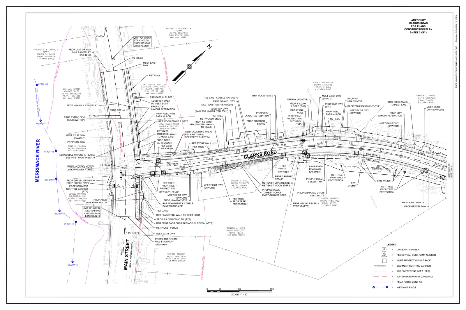
The City of Amesbury (DPW), through consultant TEC, Inc., filed a Request for Determination of Applicability for roadway and sidewalk reconstruction along Clarks Road from Main Street northeast toward Route 110 (Macy Street). Proposed work includes full‑depth pavement reconstruction and HMA mill/overlay; reconstruction of cement concrete and HMA sidewalks (typical sidewalk widths shown on plans); new vertical granite curbing; ADA‑compliant pedestrian curb ramps; a raised crosswalk; guardrail, signage and pavement markings; waterline upgrades; and minor drainage improvements.
Where and how big
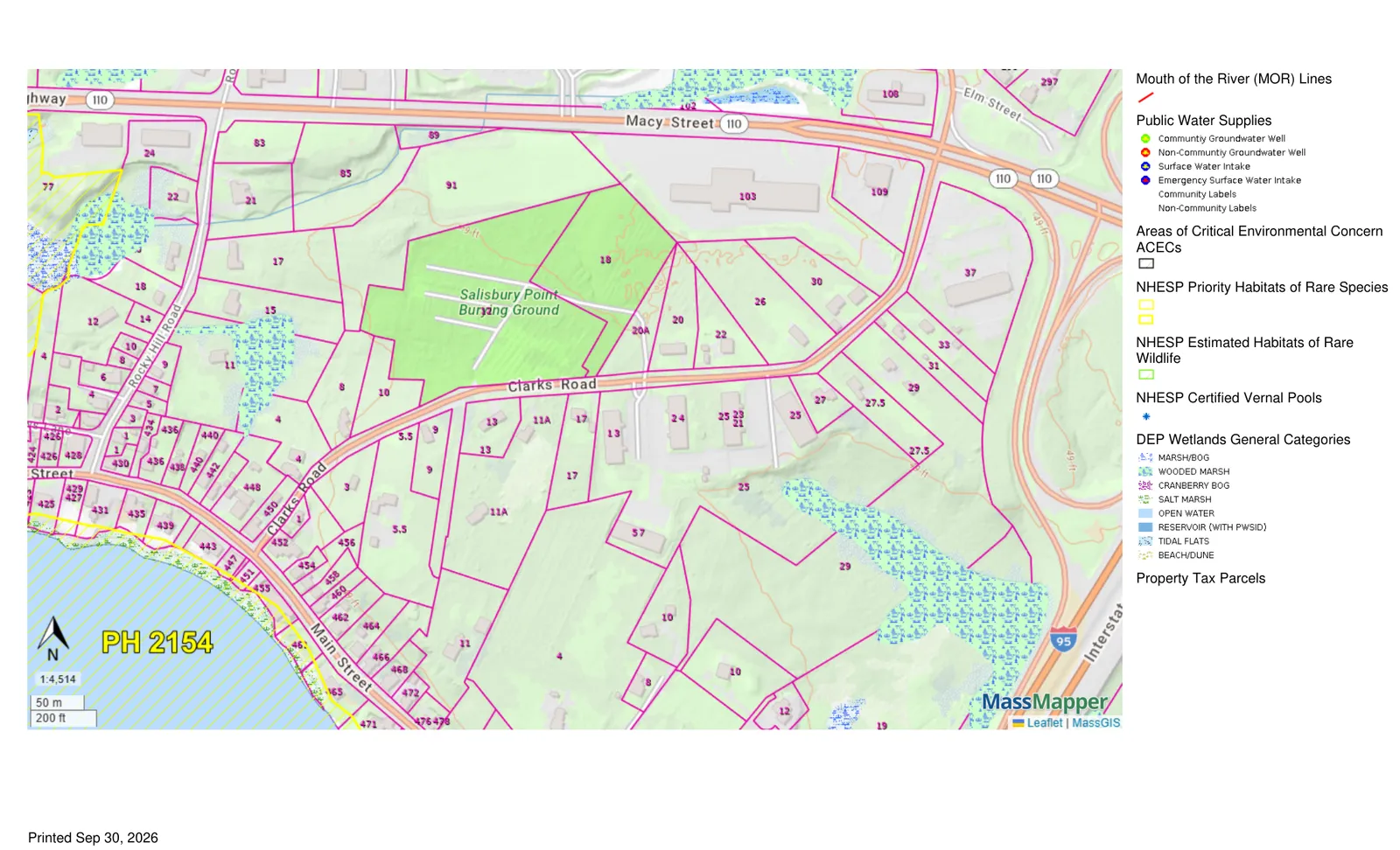
The project corridor totals about 2,825 feet (0.535 miles): roughly 2,575 feet along Clarks Road and about 250 feet at Main Street. Plans list a design speed of 25 mph and projected average daily traffic of about 2,382 vehicles in 2026 (2,912 by 2046). Approximately 12,600 square feet of the proposed work lie within the 200‑foot Riverfront Area adjacent to the Merrimack River; the riverbank was delineated with flags BA100 through BA117.
Drainage, materials and construction practices
Minor drainage upgrades within the Riverfront Area consist of two deep‑sump catch basins and one manhole that connect to an existing catch basin; the application states no new outfalls and no change to existing drainage patterns or an increase in impervious area within the Riverfront Area. Construction details on the plans show typical HMA pavement, granite curb (Type VA5), concrete sidewalks, loam and seed, and stabilized backfill. Erosion and sediment controls identified on the plans and in special provisions include inlet protection with silt sacks in catch basins, biodegradable compost filter tubes as sediment control barriers, and maintenance/inspection requirements for those devices.
Wetlands, floodplain and tree protection
A wetland delineation report documents an inland bank associated with the perennial Merrimack River and notes portions of the site within FEMA Flood Zone AE (BFE 10.5 feet). The applicant states all work in the Riverfront Area is within previously disturbed areas and that no work is proposed within the riverbank itself. Site controls and contract special provisions specify tree protection measures (trunk armoring and pruning per ANSI standards), protocols for silt sack inspection and cleaning, and procedures for installation, maintenance, and removal of sediment control barriers.
Status
The RDA package (including project narrative, WPA Form‑1, location maps, RDA plans, special provisions, and a wetland delineation report) was submitted to the Amesbury Conservation Commission on October 13, 2026. A public hearing before the Conservation Commission is noted; the Commission will determine whether the proposed work is subject to the Massachusetts Wetlands Protection Act and the Amesbury Wetlands Protection Bylaw.


