
265R Elm St; 277R Elm St; 281 Elm St; 287 Elm St; 287R Elm St; 287.5 Elm St - Notice of Intent
A 379‑unit residential development on six Elm Street parcels proposes to build on about 32.6 acres of upland within a 65.6‑acre site and includes stormwater and wetland mitigation measures under an NOI to the Conservation Commission.

AI summary
The Rocky Hill MBTA Community is a proposed 379‑unit residential development on six Elm Street parcels (approx. 65.6 acres total) that would develop about 32.6 acres of upland and preserve substantial open space and wetland corridors. The Notice of Intent reports permanent and temporary work in the Riverfront Area and buffer zones, proposes 35,317 sq ft of RFA restoration, and includes a stormwater management system sized for the 100‑year storm with recharge and pollutant‑removal features. The application and supporting plans have been submitted to the Amesbury Conservation Commission and are under review.
Gallery
Project details
What is proposed
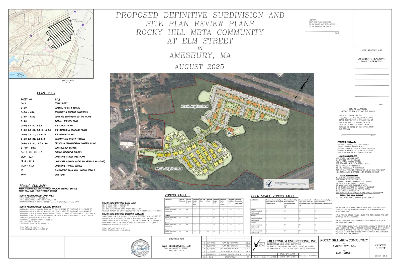
The Rocky Hill MBTA Community is a residential development proposed on six Elm Street parcels in Amesbury. The applicant (Dale Development, LLC) proposes 379 housing units across two neighborhoods: a South Neighborhood of 83 for‑sale units (single‑family, duplex, triplex, and four‑unit buildings) and a North Neighborhood of 296 units in 29 multi‑unit buildings. Ten percent of the homes are designated as Affordable Housing. The project footprint focuses on approximately 32.6 acres of upland within an overall site of about 65.6 acres and retains substantial portions of the site as natural open space, with deed restrictions proposed to protect wetlands and stream corridors; an existing historic house near Elm Street will remain.
Where and how big
The six parcels total roughly 65.6 acres east of Elm Street, with elevations from about 68 to 42 feet. Two unnamed streams flow southwest through the site toward the PowWow River; wetland resources mapped and field‑delineated on the property include two bordering vegetated wetlands (Wetlands A and B), an isolated vegetated wetland (Wetland C), intermittent and perennial stream reaches, and associated Riverfront Area (RFA) and buffer zones.
Wetlands, buffers and Riverfront Area impacts
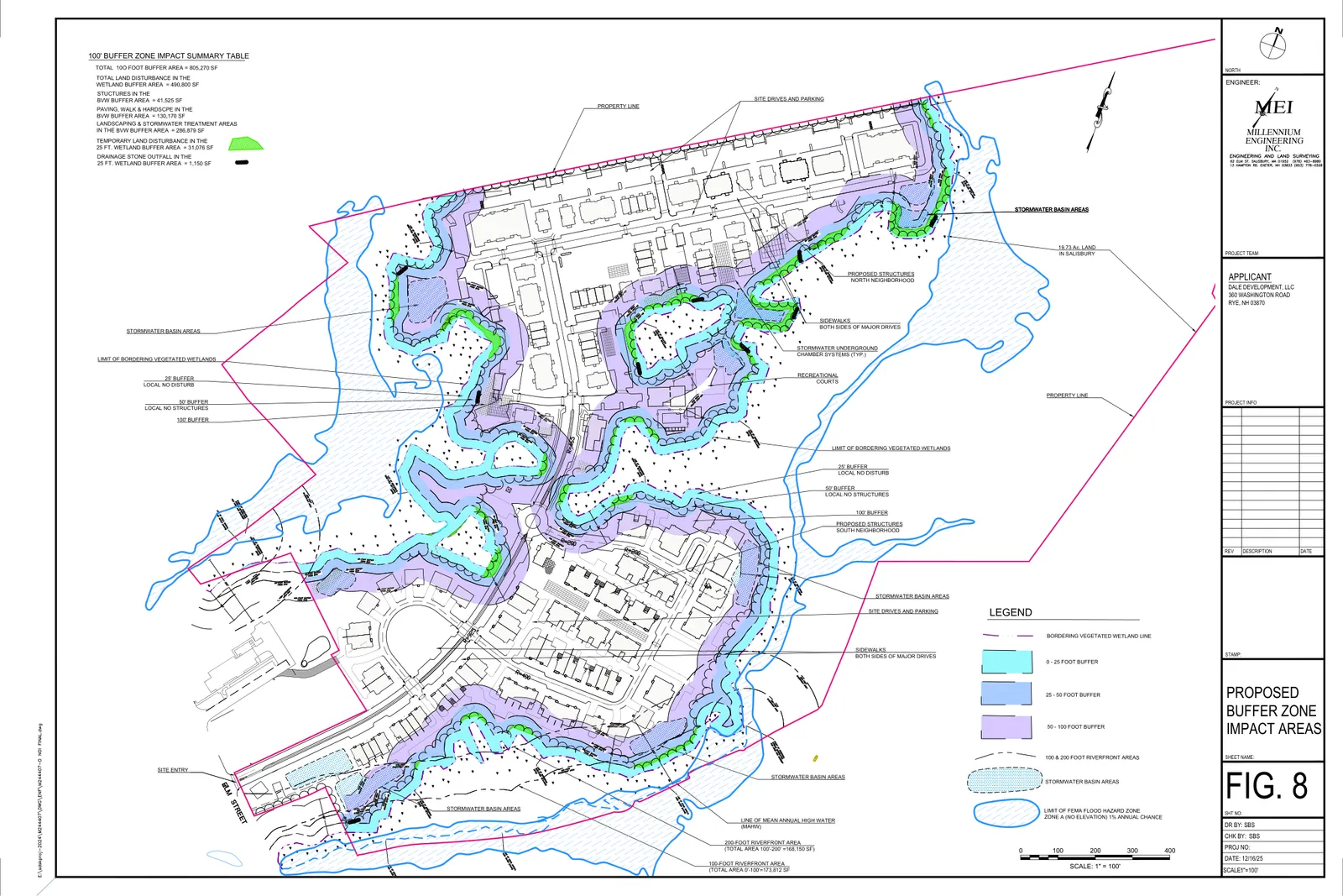
Portions of the proposed work are within the City’s 100‑foot Buffer Zone, the local 50‑ and 25‑foot buffer zones, and the 200‑foot Riverfront Area. For reference, the Riverfront Area is the land extending 200 feet horizontally from a river or perennial stream’s mean annual high water line and is subject to state and local performance standards.
The NOI reports the following RFA and buffer figures: a total on‑site RFA of 341,962 square feet; permanent RFA impacts of 32,874 square feet (9.7%); temporary construction impacts of 26,537 square feet (to be restored); and proposed RFA restoration of 35,317 square feet. Net RFA impact after restoration is reported as 24,094 square feet (7.0%). The filing also notes approximately 31,076 square feet of temporary impacts to the 25‑foot buffer zone (to be restored) and about 1,150 square feet of permanent impact within the 25‑foot buffer for a drainage stone outfall. The application relies on previously issued ORADs (Orders of Resource Area Delineation) to define wetland and stream boundaries. Where proposed work is located closer to streams than existing conditions, the applicant proposes mitigation and restoration (the NOI cites a restoration ratio exceeding 2:1 for non‑conforming square footage).
Stormwater and erosion control
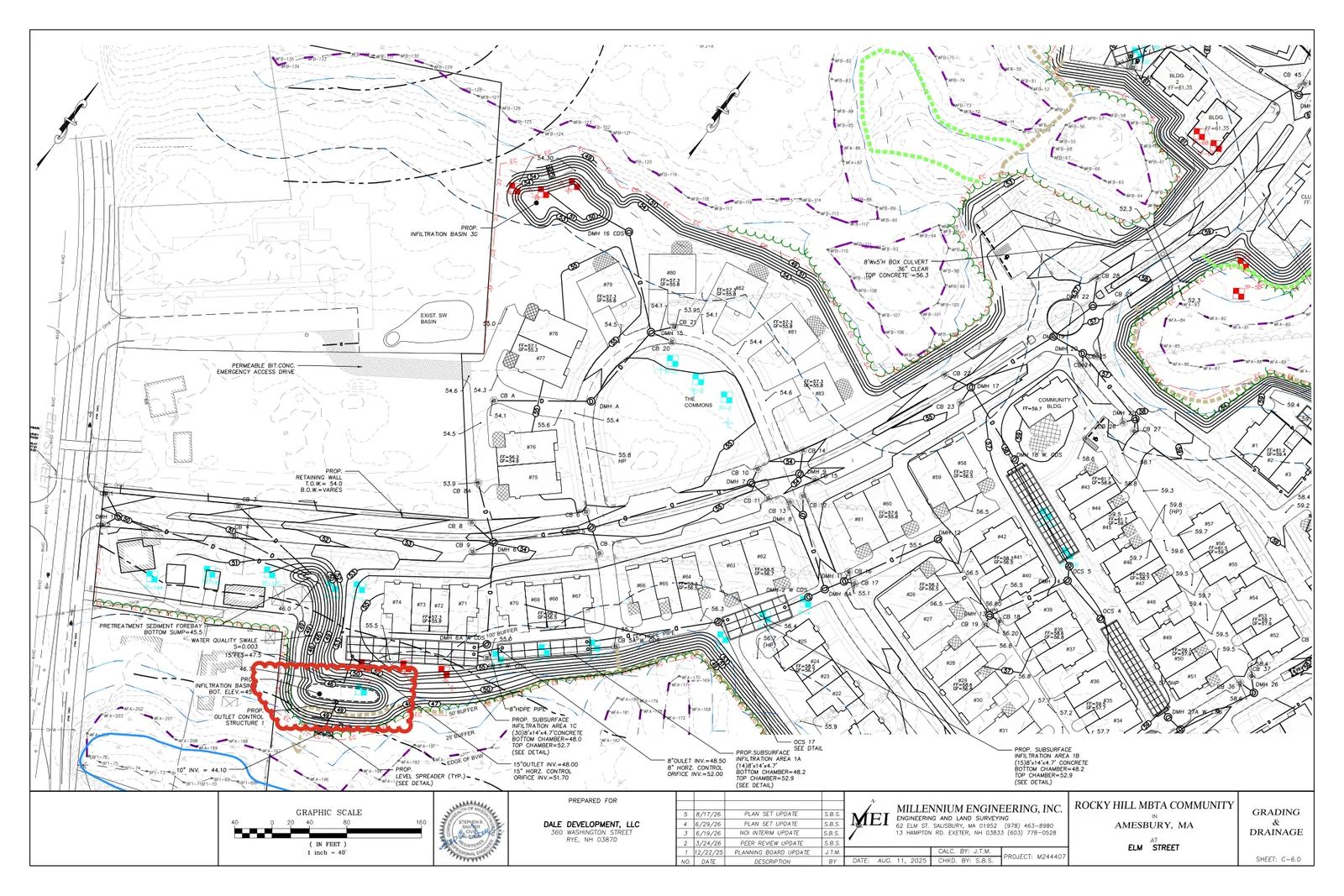
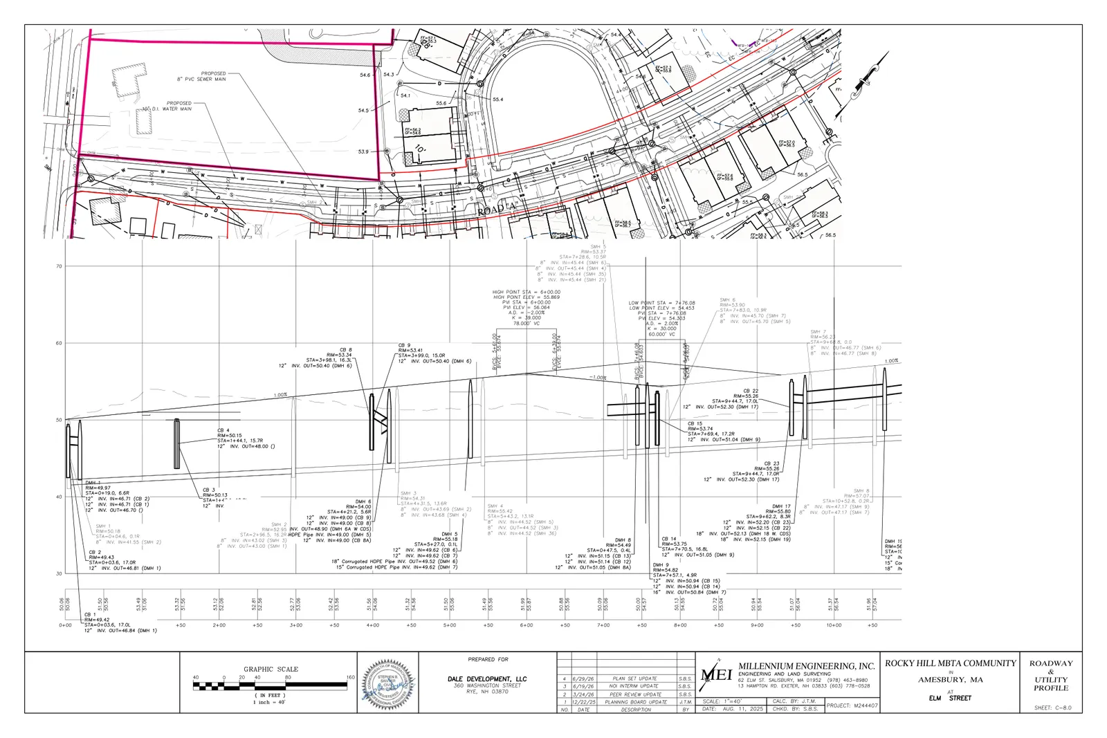
The site design includes a stormwater management system sized for the 100‑year storm and intended to collect, treat and infiltrate runoff. Key system elements described in the filing include deep‑sump catch basins, bioswales or Contech® CDS treatment units, and subsurface infiltration systems employing StormTech® Isolator Row chambers wrapped in geotextile fabric. Reported performance figures in the submission include estimated TSS removal of 85% in pre‑treatment subsurface infiltration basins and 80% in constructed wetland/surface infiltration basins; the design also reports providing 87,815 cubic feet of recharge compared with a required 26,902 cubic feet. The applicant states the design meets local TSS and Total Phosphorus reduction requirements. The NOI describes erosion and sediment controls and stipulates that temporary disturbance areas in buffers and the RFA will be restored following construction.
Site layout, access and conservation
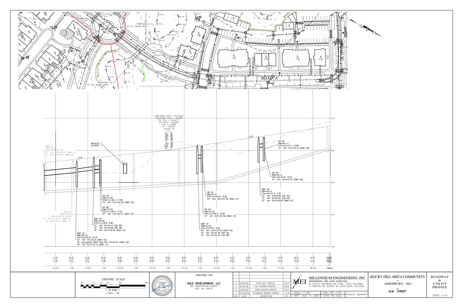
The plan shows two neighborhood clusters connected by internal streets and a roundabout; a parking area off the roundabout is designated for public trail access. The design emphasizes reduced street widths, compact lot layouts and attached single‑family units to limit impervious area. Proposed on‑site amenities include community buildings, formal greens, pocket parks and a network of trails that will serve residents and connect to adjacent forested perimeter lands. Deed restrictions are proposed to preserve wetlands, stream corridors and other sensitive areas in perpetuity.
Status
The Notice of Intent and supporting materials (site plans revised through December 22, 2025 and supplemental submissions through mid‑2026) have been submitted to the Amesbury Conservation Commission and are under Commission review. The submission package includes site plans, stormwater reports, ORAD documentation, and supplemental technical materials referenced in the NOI.
Discussion at meetings
- APPROVEApprove the Notice of Intent and issue an Order of Conditions for the Rocky Hill Development (NOI 002-1362).
- OTHERClose the public hearing for the Rocky Hill Development (NOI 002-1362).
- CONTINUEContinue the Rocky Hill NOI (EP file 002-1362) to the September meeting (Tuesday, September 8) and request Beta (peer reviewer) attend that meeting.
- APPROVEmotion to approve the beta quote wetlands portion only and the vhb stormwater portion including a visit to this hearing to discuss it with us once complete
- CONTINUEcontinue until May 4th
Documents on file


