
0 Mill St - Site Plan Review
Massachusetts Electric Company received Planning Board approval on Nov 10, 2025 to install a temporary mobile substation (≈7,110 sq ft yard) at 0 & 14 Mill Street with required wetlands review, screening plantings, and time‑limited conditions.

AI summary
Massachusetts Electric Company (National Grid) received Planning Board approval on Nov 10, 2025 to install a temporary mobile substation at 0 & 14 Mill Street, with a substation yard of about 60' × 118.5' (≈7,110 sq ft), an 8‑ft chain‑link security fence, and a 24‑ft crushed‑stone access drive. The project lies within the 200‑ft Powwow River riverfront area and is approved subject to conditions including a Conservation Commission Order of Conditions, installation of landscaped screening, time limits on operation, and other local permits (rear‑yard variance, stormwater and fence permits).
Gallery
Project details
What is proposed
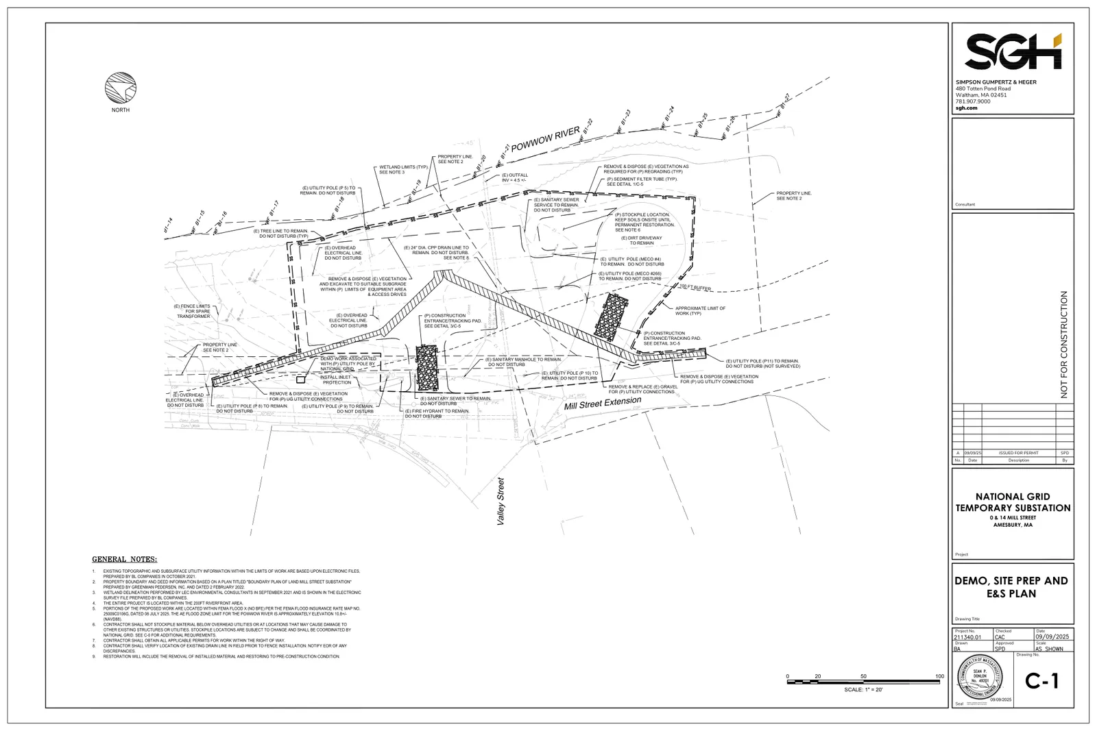
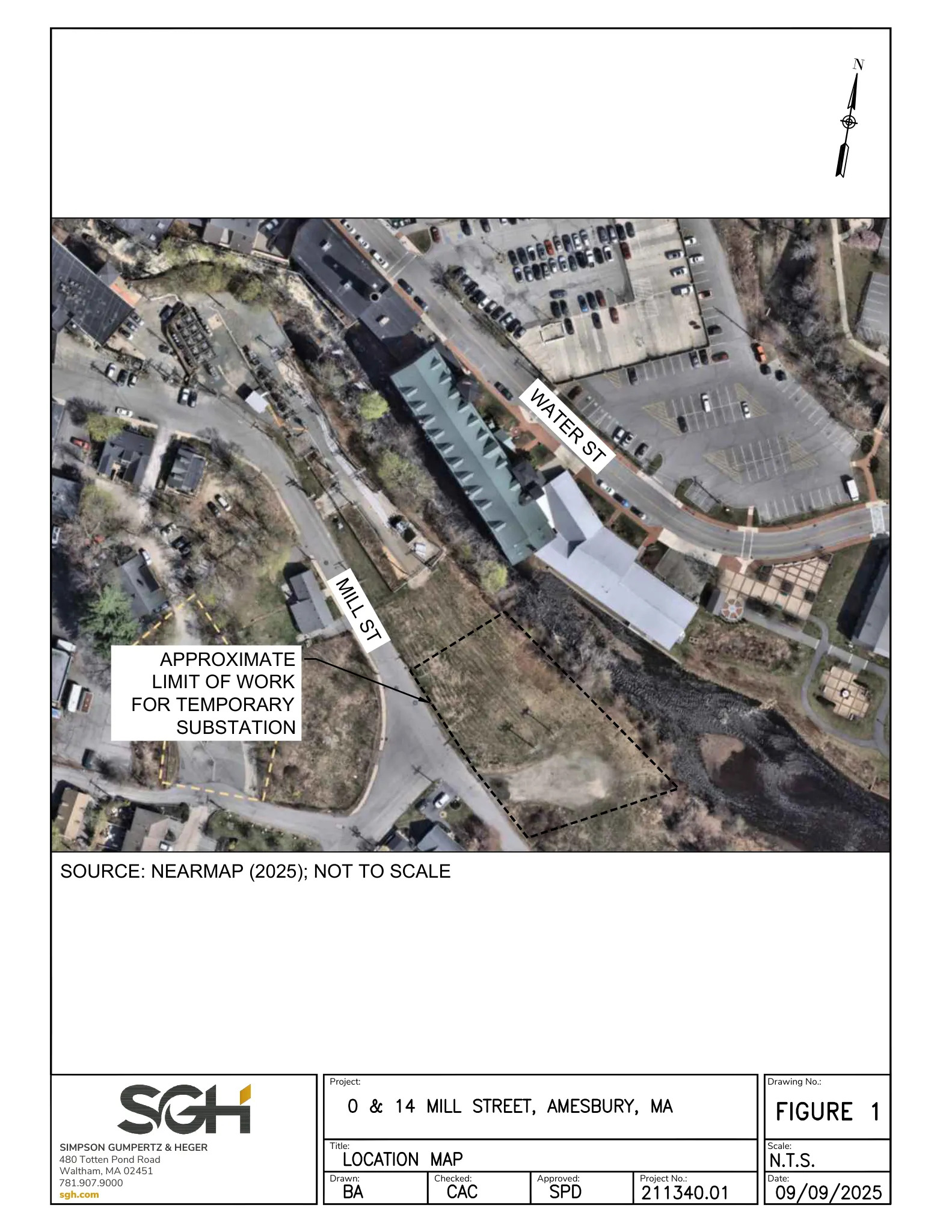
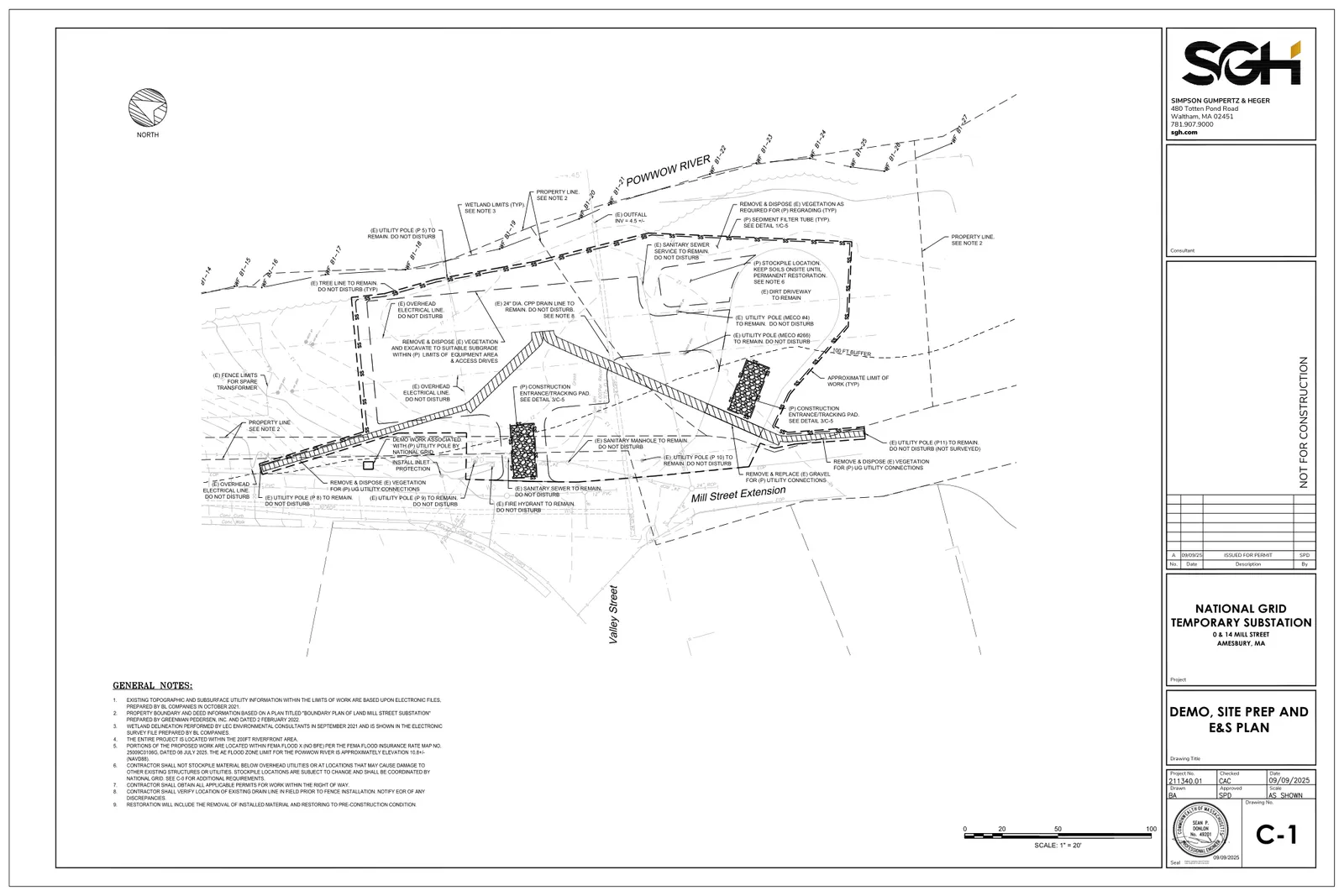
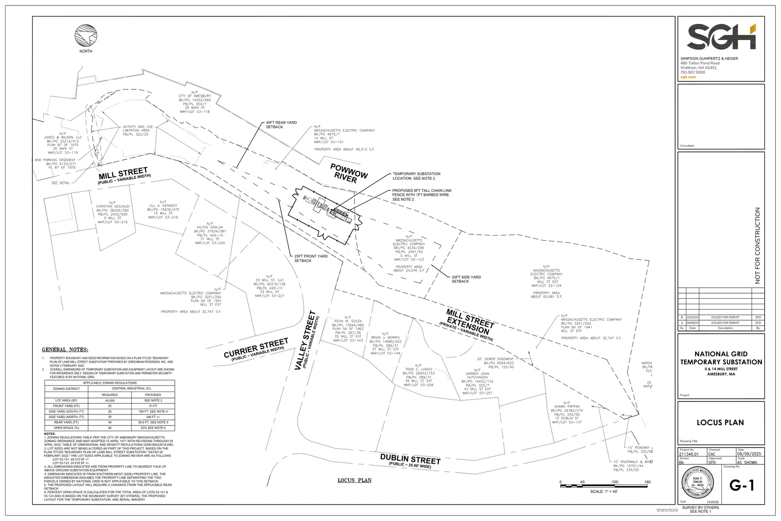
Massachusetts Electric Company (MEC / National Grid) proposes a temporary mobile electrical substation and supporting site work on MEC‑owned property at 0 and 14 Mill Street in Amesbury. The primary elements shown on the submitted Site Plan are a temporary substation yard roughly 60 feet by 118.5 feet (approximately 7,110 square feet), a temporary mobile transformer and associated electrical equipment, duct banks and underground cable work, crushed‑stone surfacing for the substation yard and access drive, and grading and limited vegetation clearing related to construction and access.
The work package also includes erosion‑and‑sediment controls during construction, restoration of disturbed areas with topsoil and seed, and a planting/screening plan to reduce visual exposure of equipment from the street and nearby properties. The plans note a transformer containment unit with a hydrocarbon filter stop valve as part of equipment containment measures.
Where and how big
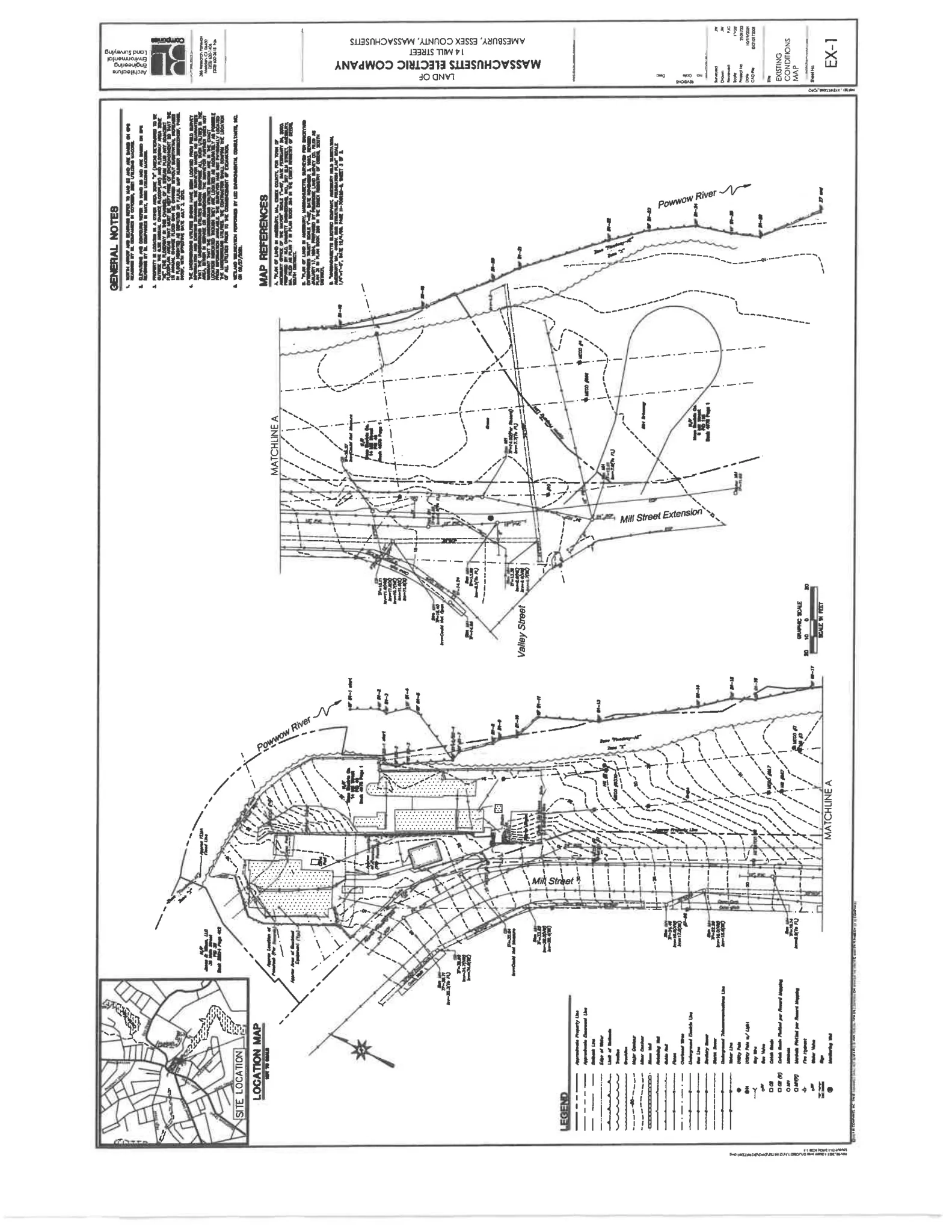
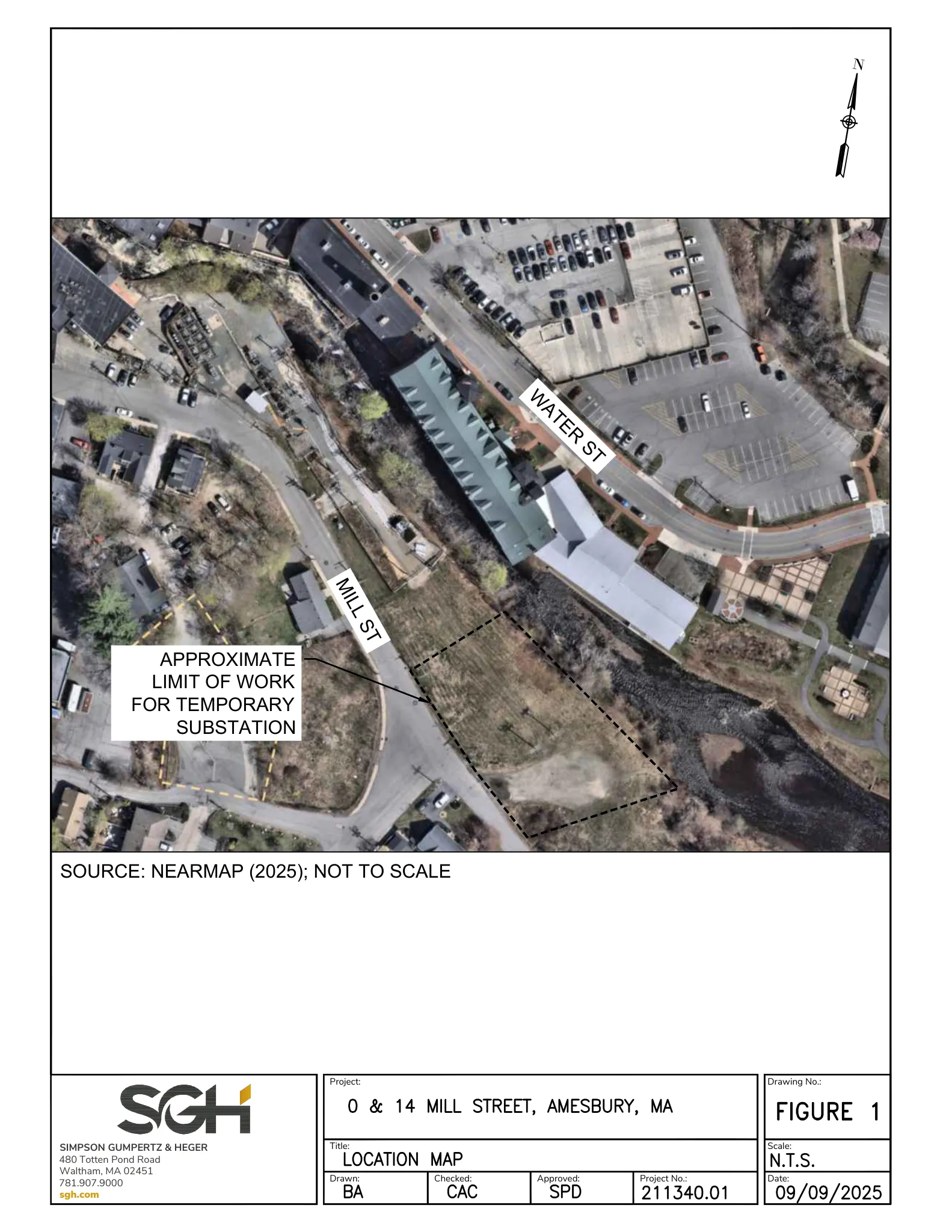
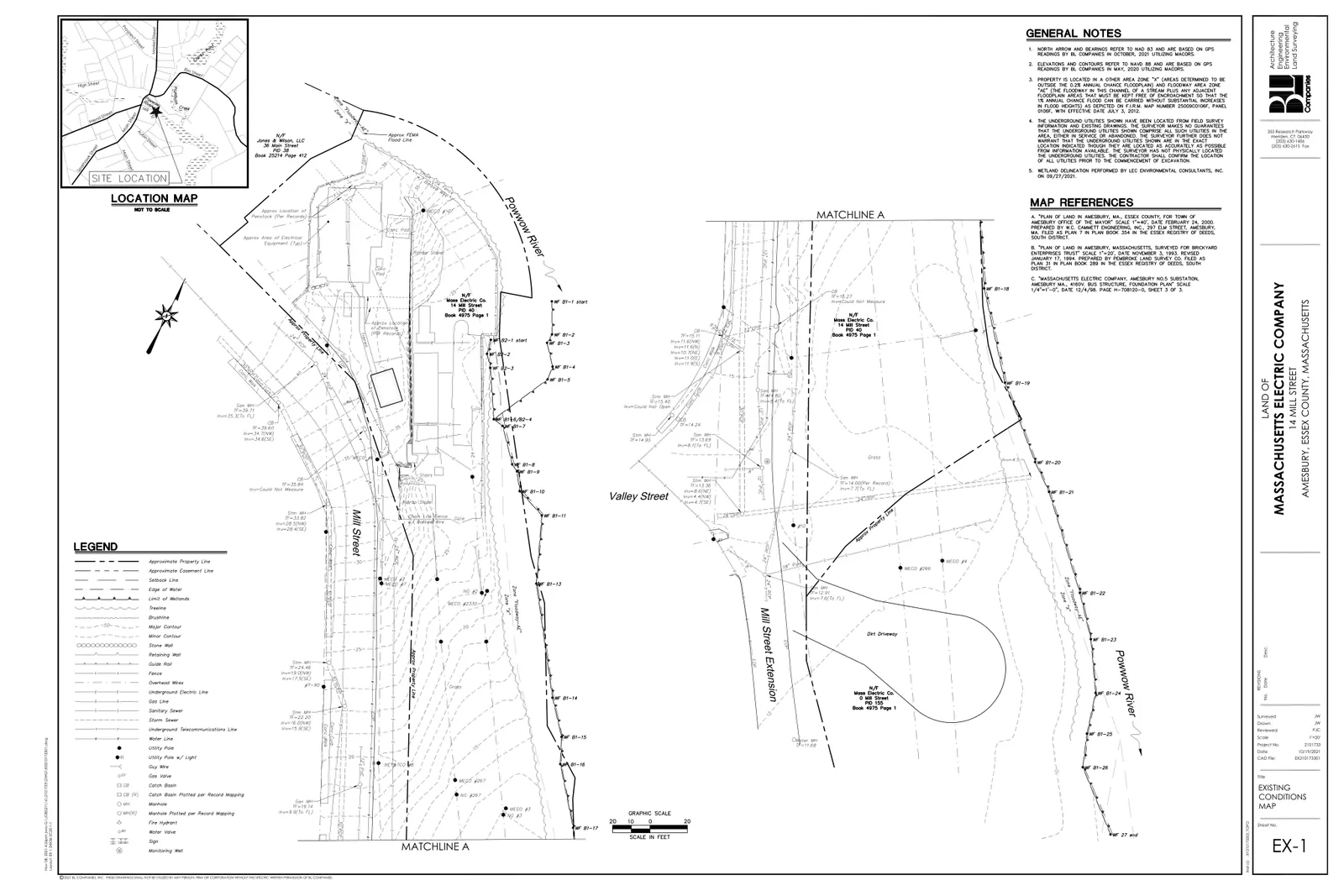
The project is on MEC property identified on City assessor maps as Map 53, Lot 121 and Lot 123. The applicant’s materials list Lot 53‑121 at about 48,313 square feet and Lot 53‑123 at about 24,576 square feet; the application describes the substation area and ancillary work located within the Central Industrial (IC) portion of the property. The temporary substation yard footprint is shown as approximately 60' × 118.5' (≈7,110 sq ft). The plan set identifies the project area as lying within the 200‑foot riverfront area adjacent to the Powwow River and notes portions of the site are within FEMA flood map designations on the cited FEMA FIRM.
Parking, access and transportation
Vehicular access is shown as a new curb cut and a 24‑foot‑wide crushed‑stone driveway at the convergence of Mill Street, Mill Street Extension and Valley Street. The facility is described as unmanned and closed to the public; routine site visits are expected to be limited to specialized utility and maintenance vehicles. The applicant’s submission states that no conventional off‑street parking or loading spaces are provided because the unmanned substation does not include buildings with gross floor area and visits are infrequent and undertaken by specialized vehicles. The plans and application indicate emergency and service access will be maintained to meet operational needs.
Screening, materials and environmental protections
Security and materials: the substation yard is shown enclosed by an 8‑foot chain‑link fence topped by 1 foot of barbed wire. The Planning Board decision additionally requires the fence to include black slats and that any barbed wire be vertical (not slanted).
Landscaping: the submitted planting plan (Sheet L‑1) shows evergreen screening along Mill Street comprised of species and quantities that include 22 Brodie redcedar (Juniperus virginiana) and 14 American holly (Ilex opaca) at 10'–12' size (ball‑and‑burlap). The Planning Board’s approval requires installed screening vegetation to be 8–12 feet in height at the time of planting and maintenance of that buffer for the duration of the temporary substation’s operation.
Environmental protections: plans include erosion and sedimentation controls (silt sock/sediment filter tube, catch basin filter bags, stabilized construction entrance), drainage details (perforated drain line, drywell), and material handling notes. The project lies within the 200‑foot riverfront area to the Powwow River and is subject to Conservation Commission review; the Planning Board conditioned its approval on the issuance of an Order of Conditions by the Amesbury Conservation Commission. An Order of Conditions is the permit the Conservation Commission issues under the Massachusetts Wetlands Protection Act that authorizes work in or near wetlands and the riverfront and that sets required mitigation and monitoring measures.
Permits, conditions and status
The Amesbury Planning Board held a public hearing and issued Site Plan Review approval on November 10, 2025, with conditions. Conditions include compliance with all applicable local, state and federal laws (except where the Board explicitly waives a requirement), obtaining and complying with an Amesbury Conservation Commission Order of Conditions, installation and maintenance of the approved landscape screening (installed at 8–12 feet tall), restoration of the site to a natural state after decommissioning, dark‑sky‑compliant lighting, and that perimeter fencing include black slats and vertical barbed wire if barbed wire is used.
Additional permits identified in the application and plan set that the applicant must secure before construction include: an Order of Conditions from the Conservation Commission (wetlands/riverfront review), a stormwater permit under the City code, a rear‑yard setback variance from the Zoning Board of Appeals (the plans indicate a rear setback variance is required), and a fence permit from the Board of Fence Viewers. The Planning Board decision also requires the applicant to provide final actions or renewals for all other permits to the Board for the record.
Time limits: the Planning Board approval is time‑limited. The decision states the Site Plan approval is valid for no more than three years from the decision issuance date and requires the applicant to seek an extension if the temporary substation has not been decommissioned and the site restored within 30 months from the date of issuance.
Next steps for the project
Before on‑site construction may proceed, the applicant must obtain the remaining required permits and approvals (notably the Conservation Commission Order of Conditions and any necessary variances and local permits) and satisfy any conditions the issuing agencies require. The Planning Board will rely on Conservation Commission action for wetlands and stormwater matters and requires documentation of final permit actions for its file. After the temporary substation is no longer needed, the applicant is required by the Planning Board decision to remove the temporary equipment and restore the site to a natural state in accordance with the approved restoration plan unless an extension is granted.
Discussion at meetings
- APPROVEI'll make a motion that we accept the site plan for 014 Mill Street subject to the nine conditions laid out in the staff memo dated November 10th, 2025.
- OTHERI motion to close the public hearing for zero and 14 Mill Street.
Documents on file


